Business Details
Your Trusted Geospatial Surveying Partner in Derby
Established over 35 years ago, Greenhatch Group has become a leader in geospatial surveying, delivering precise and innovative solutions across the UK and internationally. Our expertise spans topographical surveys, 3D laser scanning, underground utility detection, and BIM-ready modelling, supported by cutting-edge technology such as UAVs, mobile mapping systems, and high-accuracy laser scanners. With a team of over 120 professionals operating from regional offices, we combine decades of technical experience with ISO 9001-certified quality assurance to serve private, commercial, and government clients.Our commitment to excellence is demonstrated through tailored project management, adherence to international standards like RICS and IPMS, and a track record of complex projects including heritage site documentation, railway infrastructure surveys, and bathymetric analysis. By investing in continuous staff training and advanced equipment, we ensure cost-effective, high-quality deliverables that meet evolving industry demands.
Services
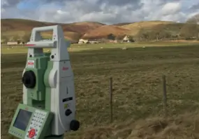
Topographical Surveys
Underground Utility Surveys
3D Revit & BIM Models
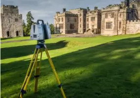
3D Laser Scanning
Bathymetric Surveys
Railway Infrastructure Surveys
Measured Building Surveys
SfM Photogrammetry
Engineering Surveys
RICS Area Reports
Highlights and features
- We have over 35 years of experience in geospatial surveying.
- We utilise cutting-edge technology including UAVs and 3D laser scanners.
- Our ISO 9001:2015 certification ensures rigorous quality control.
- We operate from regional offices covering the entire UK.
- Our team includes CAA-approved drone pilots and PTS-trained specialists.
Associations and certifications
- ISO 9001:2015
- RISQS Verified Supplier
- RICS Area Measurement Standards
Services
Topographical Surveys
Greenhatch Group conducts topographical surveys using total stations, GNSS, and UAVs to create detailed land feature maps. Our services cover greenfield and brownfield sites, urban infrastructure, and heritage locations. With ISO 9001-certified processes, we deliver accurate data for construction planning, boundary disputes, and volume analysis across the UK and internationally.
3D Laser Scanning
We utilise high-speed 3D laser scanners to capture up to 2,000,000 data points per second for precise as-built documentation. Our Leica P40 and Z+F 5010C scanners produce detailed point clouds for heritage preservation, building modelling, and engineering verification. Data is compatible with Revit and BIM workflows for construction and infrastructure projects.
Underground Utility Surveys
Our underground utility surveys employ GPR, electromagnetic location, and CCTV to map buried services in diverse environments. We comply with PAS:128 standards for utility verification in military bases, hospitals, and urban areas. Deliverables include digital records for safe excavation planning and statutory compliance.
Bathymetric Surveys
Using remote-controlled sonar boats, we conduct bathymetric surveys for rivers, lakes, and quarries. Our technology captures high-density depth data to create 3D models for flood risk analysis and watercourse management. This method reduces health and safety risks while improving data accuracy compared to traditional techniques.
Railway Infrastructure Surveys
Greenrail Solutions, our subsidiary, specialises in railway surveys using Trimble S8 total stations and GNSS. We provide track gauging, structure profiling, and OHLE height measurements for rail networks. Certified by RISQS, our deliverables support infrastructure maintenance and expansion projects across the UK.
Questions
What geospatial services does Greenhatch Group offer?
We provide topographical surveys, 3D laser scanning, underground utility detection, bathymetric surveys, railway infrastructure mapping, and BIM-ready Revit models using advanced technologies.
How experienced is Greenhatch Group in surveying?
With over 35 years of experience, we've completed projects ranging from heritage site documentation to large-scale infrastructure surveys across the UK, Europe, and the Middle East.
What technology does Greenhatch use for surveys?
We utilise Leica P40 laser scanners, UAVs with 42MP cameras, Geoslam mobile mappers, Trimble SX10 hybrid scanners, and remote-controlled sonar boats for comprehensive data capture.
Are Greenhatch's surveyors certified?
Our team includes CAA-approved drone pilots, PTS-trained railway specialists, and RICS-certified area measurement experts working under ISO 9001 quality assurance.
Can Greenhatch handle international survey projects?
Yes, we've undertaken projects in Europe and the Middle East, with regional offices across the UK ensuring efficient delivery for domestic and international clients.
How does Greenhatch ensure survey accuracy?
We implement ISO 9001:2015 quality controls, including field checks, computational verification, and management-supervised final quality assurance on all projects.