
Business Details
37 Years
experience
Expert Surveying Services in Aberdeen
Established in 1989, Granite City Surveys has built a reputation for delivering high-quality surveying services that consistently exceed client expectations. Based in Aberdeen, Scotland, we provide nationwide coverage, leveraging decades of industry experience and cutting-edge technology to deliver precise, cost-effective solutions. Our expertise spans topographical and measured building surveys, flood management, boundary dispute resolution, and engineering setting-out work, supporting clients across residential, industrial, sustainable, leisure, civil infrastructure, healthcare, and education sectors.We prioritise client collaboration, offering tailored services that address project-specific challenges while maintaining rigorous technical standards. Our commitment to excellence is demonstrated through our use of advanced surveying equipment, independent expert witness testimony, and a track record of successful projects for public and private sector clients. With a focus on precision and reliability, we empower clients to make informed decisions and bring developments to fruition.
Services
Topographical Surveys
Measured Building Surveys
Engineering Surveys
Flood Management Surveys
Utility Surveys
Details
- Year established: 1989
Highlights and features
- We have over 35 years of experience in professional surveying services.
- We utilise the latest surveying technology for accurate data collection.
- Our nationwide coverage extends across Scotland and North-east England.
- We provide independent expert witness testimony for boundary disputes.
- Our client-focused approach ensures tailored solutions for every project.
What people say
Technical expertise
Reliable service
Precise data
Client-focused approach
Advanced technology
Services
Topographical Surveys
Our topographical surveys capture detailed terrain data using advanced laser scanning and GPS technology. This service supports construction planning, flood risk assessment, and infrastructure development by providing accurate elevation models and feature mapping. Clients benefit from precise digital terrain models that inform engineering designs and land management decisions.
Measured Building Surveys
Measured building surveys produce detailed architectural drawings and 3D models of existing structures. We use laser scanning to capture precise dimensions for renovation, extension, or asset management purposes. This service ensures compliance with planning regulations and supports BIM integration for commercial and heritage buildings.
Flood Management Surveys
Flood management surveys assess land vulnerability through hydrological analysis and elevation data. We create floodplain maps and mitigation strategies for residential, industrial, and coastal developments. Our expertise helps clients meet environmental regulations and implement protective infrastructure solutions.
Boundary Dispute Resolution
Boundary dispute resolution services combine precise land measurements with legal documentation analysis. We produce compliant deed plans and provide expert witness testimony for property ownership conflicts. This service ensures legally defensible boundary definitions for residential and commercial clients.
Engineering Setting Out
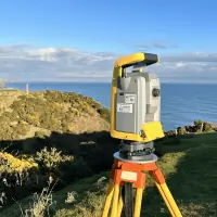
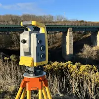
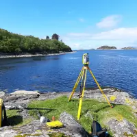
Engineering setting-out services establish precise reference points for construction projects. Using total stations and GPS, we mark critical positions for foundations, utilities, and infrastructure. This ensures alignment with design specifications and reduces costly errors during development phases.
People
Alex Bryce
Managing Director and Senior Surveyor
Alex Bryce, Managing Director, has over 15 years of surveying experience after graduating with a Masters in Geographical Information Science from The University of Edinburgh. He leads projects with technical expertise and client-focused service, ensuring precision and reliability across all surveying operations.
Questions
What surveying services do you offer?
We provide topographical surveys, measured building surveys, flood management assessments, boundary dispute resolution, and engineering setting-out services using advanced technology.
Which areas do you cover?
We operate nationwide across Scotland and North-east England, with a base in Aberdeen serving both public and private sector clients.
Can you assist with boundary disputes?
Yes, we offer expert boundary dispute resolution including precise measurements, compliant deed plans, and expert witness testimony when required.
What technology do you use?
We utilise laser scanners, GPS systems, and advanced software to ensure accurate data collection and analysis for all surveying projects.
How do you ensure project accuracy?
Our team applies rigorous quality control processes and industry-standard equipment to guarantee precise measurements and reliable deliverables for every client.
Do you work with different industries?
Yes, we support residential, industrial, healthcare, education, civil infrastructure, and renewable energy sectors with tailored surveying solutions.