Business Details
We are a family-owned Geomatics company established in 1985, dedicated to meeting global spatial data needs through innovation and precision. With over 40 years of expertise in measured building surveys, we combine advanced technology with meticulous craftsmanship. Our team utilises cutting-edge tools such as Leica GPS and 3D laser scanning to deliver rigorous control networks and detailed spatial data. We have built a reputation for excellence in hydrographic surveys, mapping river channels, lakes, and coastal areas for more than 35 years. As an approved Environment Agency contractor, we maintain an exemplary safety record while delivering cost-effective solutions.
We pride ourselves on collaborative partnerships, including a 25-year collaboration with Shoreline Surveys for near-shore and harbour projects. Our BIM models, created using Autodesk Revit, provide feature-rich information for the built environment. We specialise in Rights of Light surveys, offering 3D accurate aperture data for detailed analysis. Our drone surveying services, conducted by CAA-certified pilots, ensure rapid and reliable data capture. We are committed to transparency, hosting scan projects on Sphere XG for intuitive client access. Our client-centric approach ensures tailored solutions that exceed industry standards.
We pride ourselves on collaborative partnerships, including a 25-year collaboration with Shoreline Surveys for near-shore and harbour projects. Our BIM models, created using Autodesk Revit, provide feature-rich information for the built environment. We specialise in Rights of Light surveys, offering 3D accurate aperture data for detailed analysis. Our drone surveying services, conducted by CAA-certified pilots, ensure rapid and reliable data capture. We are committed to transparency, hosting scan projects on Sphere XG for intuitive client access. Our client-centric approach ensures tailored solutions that exceed industry standards.



Highlights and features
- We offer over 40 years of expertise in detailed measured building surveys.
- Our hydrographic services have been refined over 35 years of experience.
- We are an approved Environment Agency survey contractor with an exemplary safety record.
- We utilise Leica GPS and Precision Total Stations for high-accuracy control surveys.
- We have collaborated with Shoreline Surveys on hydrographic projects for nearly 25 years.
Services
BIM Models
Our BIM models are created using Autodesk Revit to deliver feature-rich information about the existing built environment. These models cater to architects, engineers, and construction teams requiring detailed digital representations for renovation or new development projects. By integrating precise spatial data, we enhance design accuracy and streamline project workflows.
Building Surveys
We capture complex buildings using high-accuracy 3D surveying technology, producing detailed measured surveys. Our surveys serve architects, contractors, and property developers needing precise as-built data for refurbishments, extensions, or new designs. With over 40 years of experience, we ensure compliance with exacting RICS guidelines.
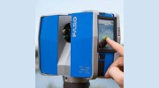
3D Laser Scanning
This service utilises advanced laser scanning to capture comprehensive spatial data regardless of project complexity. Ideal for heritage buildings, industrial sites, and infrastructure projects requiring precise dimensional accuracy. Clients gain access to 360 imagery and measurement data via the Sphere XG online portal for seamless collaboration.
Hydrographic Surveys
Our hydrographic surveys map rivers, lakes, harbours, and coastal areas using specialist equipment and 35+ years of expertise. These surveys support hydraulic modellers, environmental agencies, and maritime planners with accurate data in formats compatible with Flood Modeller and GIS systems. We prioritise safety and precision in all aquatic environments.
Channel Surveys
Since the 1980s, we have recorded detailed profiles of UK and Ireland waterways using combined data capture methods. These surveys assist engineers and environmental consultants in flood risk assessment and infrastructure planning. Data is delivered in structured formats compatible with HecRAS, Tu-Flow, and other modelling software for seamless integration.