
Business Details
We are a small specialist team based in Staffordshire, providing professional survey equipment and drone services to the construction and civil engineering sectors. We have been operating for many years, building a reputation for reliable, highquality solutions across the United Kingdom. Our expertise includes precision instrument supply, calibrated drone surveys, and the development of digital tools that streamline data processing. We employ professionalgrade drones and specialised software to produce orthomosaics, aerial imagery and 360 panoramas with georeferenced accuracy. Our engineers adhere to strict industry standards, ensuring that every dataset meets the exacting requirements of surveying and landmanagement projects. We solve complex site challenges by delivering rapid, highresolution aerial data that reduces field time and enhances decisionmaking.
Our personal, expert service means clients receive direct contact with knowledgeable staff rather than callcentre intermediaries. We guarantee fast UK delivery of all equipment, backed by comprehensive aftersales advice and ongoing technical support. Transparency is central to our approach; we provide clear quotations and detailed project briefs to avoid unexpected costs. We continuously update our offerings, recently adding proprietary digital tools and expanded drone capabilities to stay at the forefront of technology. Our commitment is to help clients achieve precise results efficiently, fostering longterm partnerships built on trust and performance.
Our personal, expert service means clients receive direct contact with knowledgeable staff rather than callcentre intermediaries. We guarantee fast UK delivery of all equipment, backed by comprehensive aftersales advice and ongoing technical support. Transparency is central to our approach; we provide clear quotations and detailed project briefs to avoid unexpected costs. We continuously update our offerings, recently adding proprietary digital tools and expanded drone capabilities to stay at the forefront of technology. Our commitment is to help clients achieve precise results efficiently, fostering longterm partnerships built on trust and performance.
Highlights and features
- We provide personal, expert service from our specialist team.
- Our equipment is carefully selected professionalgrade.
- We guarantee fast UK delivery on all orders.
- Our aftersales advice includes ongoing support.
- We offer proprietary digital tools alongside drone services.
Services
Orthomosaics
Our orthomosaic service produces highresolution, georeferenced aerial maps that combine multiple drone images into a seamless whole. These maps are ideal for construction planning, progress tracking and accurate volume calculations. Clients benefit from reduced field time, enhanced data precision and faster decisionmaking on site.
Aerial Panoramas
We capture 360 aerial panoramas that showcase largescale sites from every angle. The immersive images support marketing, stakeholder presentations and comprehensive site visualisation. Users gain a compelling visual tool that efficiently enhances communication and reduces the need for physical visits.
Aerial Imagery
Our aerial imagery service delivers highresolution still photos taken from drone platforms. These images are suited for inspections, planning, presentations and website content. Clients receive precise, colouraccurate visuals that streamline reporting and support informed decisionmaking effectively throughout the project lifecycle.
Drone Surveying
Our drone surveying service provides comprehensive aerial data collection for construction, civil engineering and land management projects. We employ calibrated professionalgrade drones and specialised software to ensure high accuracy and repeatability. Clients benefit from faster site assessments, reduced labour costs and reliable datasets that meet industry standards.
Survey Equipment
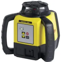
We supply precision survey equipment tailored for construction and civil engineering professionals across the UK. Our catalogue includes calibrated instruments, calibration support services and digital tools for accurate field measurements. Customers receive expert advice, fast UK delivery and ongoing aftersales support to maximise productivity.