
Business Details
36 Years
experience
Emergency
services
Expert Geospatial Surveying Services
Established in 1990, we are Ireland's leading geospatial surveying company with over three decades of expertise in delivering precision surveying solutions. Our team of 50+ dedicated surveyors operates across five specialist departments, providing comprehensive services including topographic, utility, BIM, drone, and measured building surveys. With a proven track record of completing 10,000+ projects globally, we combine advanced technology with rigorous quality standards to meet client needs. Our directors and senior management bring decades of industry experience, supported by a diverse team with international expertise across Ireland, the UK, Europe, and the Middle East. We maintain a relentless focus on health and safety while achieving 95% client satisfaction rates through transparent communication and tailored project delivery.Our investment in cutting-edge technologies like 3D laser scanning and digital twin creation ensures we remain at the forefront of geospatial innovation. As active members of professional institutions, we uphold the highest industry standards while delivering measurable value to clients through accurate data acquisition and actionable insights. Our collaborative approach fosters knowledge sharing between surveyors, enabling continuous improvement in service delivery. With both national and international project capabilities, we provide scalable solutions for complex infrastructure developments. This combination of experience, technical capability, and client-centric ethos has cemented our reputation as a trusted partner in geospatial surveying.
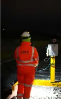
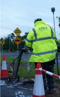

Services
Topographic Surveys
Underground Utility Surveys
BIM Surveys
Drone Surveys
Measured Building Surveys
Digital Twin Surveys
Conservation Surveys
Mobile Mapping
Rail Surveys
Hydrographic Surveys
Details
- Year established: 1990
Highlights and features
- We have over 30 years of experience in geospatial surveying
- 95% of our clients would recommend us to others
- We have completed 10,000+ survey projects
- Our team includes 50+ surveyors across five specialist departments
- We maintain a strong health and safety culture
What people say
Exceptional service
Professional team
Accurate results
Timely delivery
Technical expertise
Services
Topographic Surveys
We conduct detailed topographic surveys mapping natural and built environments using advanced surveying equipment. Our services capture precise elevation data, terrain features, and man-made structures to support infrastructure planning and development. Clients receive accurate digital terrain models and contour maps for engineering and construction applications.
Underground Utility Surveys
Our underground utility surveys locate and map subsurface infrastructure using ground-penetrating radar and electromagnetic detection. We identify water, gas, electrical, and telecom services to prevent damage during construction. Clients receive detailed utility maps with 3D positioning for safe excavation planning.
BIM Surveys
We create precise Building Information Models using laser scanning and photogrammetry. Our BIM surveys support construction projects with accurate as-built data for design coordination and facility management. Clients benefit from clash detection and improved project lifecycle management through digital twin technology.
Drone Surveys
Our drone surveys capture high-resolution aerial data for large-scale mapping and infrastructure inspections. Using UAV technology, we provide rapid site surveys, progress monitoring, and hard-to-reach area inspections. Clients receive orthomosaic maps, 3D models, and volumetric calculations for construction and environmental projects.
Measured Building Surveys
We produce detailed measured building surveys for existing structures using laser scanning and traditional methods. Our services include floor plans, elevations, and sections for renovation and conservation projects. Clients receive accurate CAD drawings and BIM models compliant with industry standards for building documentation.
People
Philip Mulreid
Director
Philip Mulreid has over 20 years' experience in geospatial surveying, leading major infrastructure projects across Europe. He specialises in BIM implementation and digital surveying technologies, driving innovation in the company's service delivery.
Ian Mulreid
Director
Ian Mulreid brings 18 years' expertise in utility surveying and project management. He oversees operational excellence and health & safety compliance, ensuring the company maintains its 95% client satisfaction rating through rigorous quality control.
Questions
What geospatial services do you offer?
We provide topographic, utility, BIM, drone, measured building, hydrographic, and mobile mapping surveys using the latest technology for infrastructure projects.
How experienced is your team?
With 30+ years' experience and 50+ surveyors, our team has completed 10,000+ projects across Ireland, the UK, Europe, and the Middle East.
What client satisfaction levels do you achieve?
95% of our clients would recommend us, based on 2023/2024 satisfaction surveys measuring service quality and project outcomes.
Do you handle international projects?
Yes, our team has extensive international experience delivering surveys for infrastructure developments in the UK, Europe, and the Middle East.
How do you ensure survey accuracy?
We use advanced laser scanning, UAV technology, and ground-penetrating radar combined with rigorous quality control processes for all survey deliverables.
Can you assist with emergency surveys?
Yes, we provide rapid response for emergency monitoring and survey requirements, with recent experience in urgent infrastructure assessments.