
Business Details
We are Geo-Info Ltd, a leading provider of geospatial surveying solutions. Our mission is to deliver precision-driven geospatial data capture and surveying expertise that empower our clients to make informed, efficient, and cost-effective decisions at every stage of a project. We have over a decade of experience in providing high-accuracy 2D and 3D topographic surveys, measured building surveys, and utility surveys. Our team specialises in delivering highly accurate, BIM-ready measured building surveys tailored to suit a wide variety of client needs. We use the latest 3D laser scanning, LiDAR technology, and advanced surveying software to capture every structural detail with millimetre precision. We are trusted partners to architects, quantity surveyors, Tier 1 contractors, and professionals across the design, build, rail, civil engineering, and construction sectors. Our expertise includes high-accuracy land surveying services designed to support projects of every size and complexity. We also specialise in river section surveys, CCTV drainage and utility surveys, and underground utility services.
We provide specialist Underground Utility Surveys to give our clients a clear and reliable understanding of what lies beneath the surface. Our surveys enable clients to effectively see the unknown. We are experts in delivering PAS 128-compliant Utility Surveys, offering a structured, industry-recognised approach to underground mapping. We combine over a decade of experience with the latest geospatial surveying technologies to deliver results you can trust. From 3D laser scanning and LiDAR to GNSS positioning, and PAS 128 utility mapping, our team provides the high-precision insights needed to design, build, and manage with confidence. As part of SML Geospatial, we combine the strength of a wider network with a personal, client-focused approach. We understand that accurate, reliable data is the foundation of every successful project. That's why we combine our expertise with the latest geospatial surveying technologies to deliver results you can trust.
We provide specialist Underground Utility Surveys to give our clients a clear and reliable understanding of what lies beneath the surface. Our surveys enable clients to effectively see the unknown. We are experts in delivering PAS 128-compliant Utility Surveys, offering a structured, industry-recognised approach to underground mapping. We combine over a decade of experience with the latest geospatial surveying technologies to deliver results you can trust. From 3D laser scanning and LiDAR to GNSS positioning, and PAS 128 utility mapping, our team provides the high-precision insights needed to design, build, and manage with confidence. As part of SML Geospatial, we combine the strength of a wider network with a personal, client-focused approach. We understand that accurate, reliable data is the foundation of every successful project. That's why we combine our expertise with the latest geospatial surveying technologies to deliver results you can trust.

Highlights and features
- We provide over a decade of experience in geospatial surveying
- We deliver highly accurate, BIM-ready measured building surveys
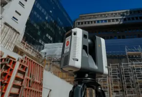
- We use the latest 3D laser scanning, LiDAR technology, and advanced surveying software
- We provide PAS 128-compliant Utility Surveys
- We combine our expertise with the latest geospatial surveying technologies
Services
Topographic Surveys
We provide high-accuracy 2D and 3D topographic surveys for major road, rail, and housing developments. Our surveys deliver detailed mapping and terrain data essential for design and planning. We support projects of every size and complexity.
Measured Building Surveys
We specialise in delivering highly accurate, BIM-ready measured building surveys tailored to suit a wide variety of client needs. Our surveys provide precise as-built information and BIM-ready deliverables for architects, planners, and contractors.
Utility Surveys
We provide specialist Underground Utility Surveys to give our clients a clear and reliable understanding of what lies beneath the surface. Our surveys enable clients to effectively see the unknown and reduce risk, prevent costly delays, and protect existing services.
Rail Surveys
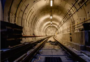
We provide high-accuracy rail surveys for major rail developments, delivering detailed mapping and terrain data essential for design and planning. Our surveys support projects of every size and complexity.
CCTV & Drainage Surveys
We provide CCTV drainage and utility surveys, offering a clear insight into underground infrastructure. Our surveys are fully aligned with PAS 128 standards and provide a structured, industry-recognised approach to underground mapping.