
Business Details
15 Years
experience
Expert Land Surveying & Engineering Services in Wisbech
M F M Land Surveys & Engineering Service is a family-run business established in 2011, operating from West Norfolk with nationwide coverage. Our team combines over two decades of hands-on experience in construction and civil engineering with cutting-edge surveying technology. We specialise in delivering precise topographical surveys, measured building surveys, and site engineering solutions tailored to client needs. Our approach prioritises personal service and professionalism, ensuring accuracy and reliability across diverse projects.From laser scanning to volumetric reporting, we support design teams with data-driven insights. We also provide training to enhance client engineering capabilities, maintaining efficiency without compromising quality. Our expertise extends to 3D modelling and flood risk assessment, serving both private and public sector clients. With a proven track record in complex contracts, we deliver timely, cost-effective solutions. Our commitment to excellence has solidified our reputation as trusted surveyors across the UK.
Services
Topographical Surveys
Building Surveys
Site Engineering
Laser Scanning
CAD Drafting
Details
- Year established: 2011
Highlights and features
- We have over 20 years of experience in construction and civil engineering surveying.
- Our family-run business prioritises personal service and client-specific solutions.
- We utilise the latest surveying equipment for high-accuracy data collection.
- We provide nationwide coverage with local expertise in West Norfolk.
- Our team offers training to enhance client engineering capabilities.
Services
Topographical Surveys
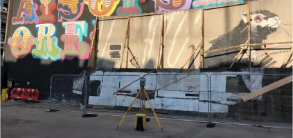
We conduct detailed topographical surveys using advanced equipment to capture terrain features and elevations. Our data supports flood risk assessments, infrastructure planning, and construction projects. Clients receive accurate, customised deliverables for design and development purposes.
Building Surveys
Our measured building surveys produce floor plans, elevations, and sections for residential and commercial properties. We use laser scanning to document existing structures, aiding renovation or redevelopment projects with precise dimensional data.
Site Engineering
We provide setting-out services and on-site engineering for construction projects. Our team ensures accurate implementation of designs using modern technology, while offering training to enhance client team capabilities.
Laser Scanning
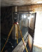
Our laser scanning services create high-resolution 3D models of structures and landscapes. These models support visualisation, design validation, and heritage preservation projects with millimetre-level accuracy.
CAD Drafting
We convert survey data into detailed CAD drawings, including floor plans, elevations, and cross-sections. Our deliverables meet industry standards for architects, engineers, and contractors during project planning phases.
Questions
What surveying services do you offer?
We provide topographical surveys, building surveys, site engineering, laser scanning, and CAD drafting for construction and development projects nationwide.
How experienced is your team?
Our staff have over 20 years of experience in construction and civil engineering, with expertise in both traditional and modern surveying techniques.
Do you work outside West Norfolk?
Yes, while based in Wisbech, we operate across the UK, supporting projects from Shoreditch to Wells-next-the-Sea.
Can you assist with flood risk assessments?
Yes, we conduct topographical surveys and elevation analysis to support flood planning and coastal defence projects.
Do you provide training for engineering teams?
Yes, we offer on-site training to enhance client teams' surveying and engineering capabilities during projects.