
Business Details
Expert Chartered Surveyors in Newcastle
Reencon Chartered Surveyors Chartered Surveyors has established itself as a leading land surveying firm in Northern Ireland, serving Belfast, Newcastle, Newry, Ballynahinch, and Armagh. With 35 years of combined expertise, we specialise in high-precision services including 3D modelling, scan-to-BIM, underground utility mapping, and topographical surveys. Our approach merges traditional surveying excellence with cutting-edge technology to deliver reliable data for architects, engineers, and developers. We prioritise personalised service, ensuring clients work with the same expert throughout their projects.Our commitment to accuracy is demonstrated through millimetre-precise 3D laser scanning and rapid utility detection reports. Backed by positive Google reviews and real-world case studies, we provide tailored solutions for boundary disputes, construction planning, and facility management. Our team maintains strong industry knowledge through continuous engagement with technological advancements, offering clients confidence in every project phase from initial surveys to long-term asset management.
Services
3D Modelling
Topographical Surveys
Utility Mapping
Dispute Visualisation
BIM Surveying
Photographic Surveys
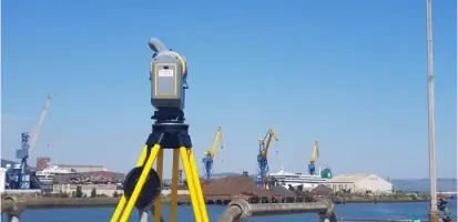
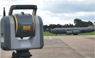
Laser Scanning
Case Studies
Highlights and features
- We have 35 years of combined experience in land surveying
- We use advanced 3D laser scanning technology for millimetre accuracy
- Our team provides consistent expert support throughout your project
- We specialise in resolving boundary and structural disputes
- We offer rapid utility detection with same-day reports
What people say
Millimetre-accurate results
Rapid utility detection
Consistent expert support
Detailed case studies
Reliable data
Services
3D Modelling
Transform point cloud data into intelligent 3D models for construction planning and facility management. Our BIM-compatible models support architects and engineers with accurate geometric representations. Enhance project collaboration through shared digital environments that improve decision-making and reduce errors.
Topographical Surveys
Create detailed terrain maps linked to the Ordnance Survey National Grid. Our surveys capture land features and elevation data for planning applications and construction projects. Deliverables include contour plans and digital elevation models to support site analysis and development proposals.
Utility Mapping
Locate hidden infrastructure using ground-penetrating radar and electromagnetic detection. Generate accurate utility maps with same-day reports for safe excavation planning. Prevent service strikes during construction through precise subsurface data visualisation.
Dispute Visualisation
Resolve property conflicts with 3D visual evidence of boundary conditions. Create measurable digital replicas for legal proceedings and neighbour disputes. Our models provide clear spatial relationships between structures and land parcels to support resolution processes.
Laser Scanning
Capture millimetre-accurate building measurements using high-density laser technology. Convert scan data into detailed architectural drawings and as-built records. Support renovation projects with precise geometric information for heritage preservation and modernisation schemes.
Questions
What surveying services do you offer?
We provide 3D modelling, topographical surveys, underground utility mapping, BIM support, and dispute resolution visualisation services.
Do you serve areas outside Newcastle?
We cover Belfast, Newry, Ballynahinch, Armagh, and surrounding regions with our surveying services.
How quickly can you complete a utility survey?
Our rapid detection service provides same-day utility reports for urgent project requirements.
What payment methods do you accept?
We accept payments via BACS transfers and cheques for our surveying services.
Are your surveyors qualified?
We are a fully chartered surveying practice with 35 years of combined industry expertise.
Can you assist with boundary disputes?
Our 3D visualisation services provide measurable evidence to resolve property boundary and structural conflicts.