
Business Details
32 Years
experience
Chartered Surveyors in London | Arena Property Services
Arena Property Services was founded in 1994 and has since established itself as a leading provider of chartered building and land surveying services. Our expertise spans 3D laser scanning, building information modelling (BIM), measured building surveys, and topographical surveys, all conducted to the rigorous standards set by the Royal Institution of Chartered Surveyors (RICS). With over 30 years of experience, we combine cutting-edge technology such as Leica RTC360 scanners and Autodesk Revit software with traditional surveying methods to deliver precise, reliable data for clients across the UK and internationally. Our team of certified professionals operates from regional offices in Edinburgh, Newcastle, Liverpool, Manchester, Birmingham, Southampton, and our London headquarters, ensuring nationwide coverage and localised knowledge. We maintain SafeContractor accreditation and Civil Aviation Authority (CAA) approval for aerial surveys, demonstrating our commitment to safety and quality.Our services support architects, engineers, and developers in planning, design, and asset management, with a focus on accuracy, efficiency, and client satisfaction. By processing data into compatible formats like AutoCAD and Revit, we enable seamless integration into clients' workflows. Our quality assurance procedures, personally overseen by the director, ensure compliance with RICS guidelines and industry best practices. We specialise in reducing costly site revisits through advanced point cloud data extraction and digital drafting. With a proven track record in complex projects ranging from heritage sites to infrastructure developments, we provide tailored solutions that meet diverse client needs while maintaining transparency and ethical standards.
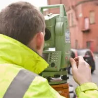
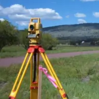
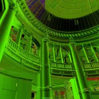
Services
3D Laser Scanning
BIM Modelling
Measured Building Surveys
Topographical Surveys
Utility Surveys
Aerial Inspections
Floor Area Analysis
Rights of Light Modelling
GPS Surveys
Point Cloud Drafting
Details
- Year established: 1994
Highlights and features
- We have over 30 years of experience in chartered surveying.
- We use the latest Leica RTC360 scanners and CAD software.
- Our work complies with RICS guidelines and industry standards.
- We are SafeContractor accredited and CAA approved for aerial surveys.
- Regional surveyors cover the UK from Edinburgh to Southampton.
Associations and certifications
- RICS
- SafeContractor
Services
3D Laser Scanning
3D laser scanning captures precise spatial data using high-speed point cloud technology. This method achieves 1.6mm accuracy, creating detailed digital twins of buildings, infrastructure, and landscapes. Clients benefit from reduced site revisits and seamless integration with BIM software for design validation and facility management.
BIM Modelling
BIM modelling transforms point cloud data into intelligent 3D models using Autodesk Revit. These models support architects and engineers in visualising construction projects, coordinating spatial elements, and managing assets throughout their lifecycle. Our RICS-compliant deliverables enhance project efficiency and decision-making.
Measured Building Surveys
Measured building surveys document existing structures with millimetre precision. We produce floor plans, elevations, and sections for refurbishment, space planning, or conservation projects. Our RICS-regulated surveys use non-contact techniques to minimise disruption while ensuring compliance with industry standards.
Topographical Surveys
Topographical surveys map terrain features and man-made structures using GPS and total stations. Deliverables include contour models, volume calculations, and digital terrain data for site analysis. These surveys support infrastructure projects, environmental assessments, and development planning.
Utility Surveys
Utility surveys locate buried services using electromagnetic detection and ground-penetrating radar. We identify cable routes, pipe depths, and potential conflicts to prevent damage during construction. Our HSG47-compliant reports reduce project risks and ensure adherence to CDM regulations.
People
Stuart Jackson
Operations Manager
Stuart Jackson oversees daily operations, ensuring efficient project delivery across the UK. With extensive surveying experience, he manages regional teams and maintains quality standards in line with RICS requirements.
Philip Paul
Director
Philip Paul, as Director, leads strategic direction and technical excellence. A chartered building surveyor with over 30 years' experience, he personally oversees quality assurance and client relationships for complex projects.
Questions
What surveying technologies do you use?
We use Leica RTC360 3D laser scanners, Autodesk Revit for BIM, GPS systems, and CAA-approved UAVs for aerial surveys.
Are you regulated by professional bodies?
Yes, we are regulated by the Royal Institution of Chartered Surveyors (RICS) and hold SafeContractor accreditation.
Do you operate outside London?
We have regional surveyors in Edinburgh, Newcastle, Liverpool, Manchester, Birmingham, and Southampton, with international capabilities.
How accurate are your measurements?
Our 3D laser scanning achieves 1.6mm accuracy, and all surveys comply with RICS guidelines and industry standards.
Can you assist with heritage building surveys?
Yes, we specialise in surveying listed buildings and heritage sites using non-contact methods to preserve structural integrity.
What file formats do you provide?
We deliver data in DWG, DXF, DGN, Revit, and point cloud formats, compatible with major CAD and BIM software.