
Business Details
Your Trusted Partner for Land Surveying Solutions
At J D Surveying we provide first class surveying and engineering services for clients across the South East of England and throughout the UK. Our commitment to delivering professional and timely services while maintaining exceptional quality has established us as trusted experts in the field. With extensive experience spanning small domestic projects to large-scale commercial developments, we combine technical expertise with cutting-edge technology to meet diverse client needs. Our services include topographical surveys, measured building surveys, 3D laser scanning, drone surveys, and precision site engineering tailored to specific project requirements. We prioritise accuracy in establishing site control, gridlines, and level datums to millimetre precision, ensuring construction elements align perfectly with design specifications. Utilising advanced GNSS technology and software, we deliver surveys to OS National Grid standards or local grids, alongside volumetric calculations and structural monitoring services.Our team's dedication to client collaboration is evident in testimonials highlighting competitive pricing, prompt delivery of detailed drawings, and seamless integration with architectural and construction teams. With a proven track record in resolving boundary disputes, supporting planning permissions, and providing as-built documentation, we offer comprehensive solutions that combine technical excellence with practical problem-solving. Our investment in state-of-the-art equipment, including UAV drones and 3D laser scanners, ensures clients receive precise data in formats ranging from point clouds to detailed floorplans. By maintaining rigorous quality standards and focusing on clear communication, we ensure every project benefits from our technical expertise and commitment to excellence.
Services
Topographical Surveys
Measured Building Surveys
3D Laser Scanning
Drone Surveys
Site Engineering
As-built Surveys
GPS Surveys
Volume Surveys
Structural Monitoring
Highlights and features
- We utilise state-of-the-art drone and laser scanning technology for precise data capture
- Our team delivers millimetre-accurate site engineering for construction projects
- We provide tailored survey solutions from small domestic properties to large commercial sites
- Our OSGB36-compliant GPS surveys ensure national grid accuracy standards
- We offer rapid turnaround of detailed architectural drawings and 3D models
What people say
Detailed drawings for architect
Competitive price
Prompt delivery
Professional service
Worked well with team
Services
Topographical Surveys
We conduct detailed topographical surveys mapping terrain features and elevations. Our surveys support planning permissions, boundary disputes, and development projects with precise land measurements. Using advanced equipment, we deliver tailored mapping solutions for sites ranging from small properties to large agricultural areas.
3D Laser Scanning
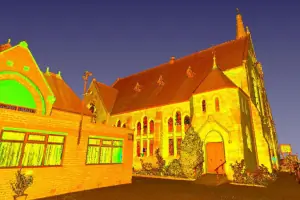
Our 3D laser scanning creates accurate point clouds and building models. This technology produces detailed elevations, floorplans, and sections for refurbishment or documentation purposes. We convert complex geometries into precise digital representations for architectural and engineering applications.
Drone Surveys
We perform aerial surveys using UAV drones for topographic mapping and volumetric calculations. Our drone technology captures high-resolution imagery and 3D data for large sites, enabling efficient site analysis and progress monitoring with minimal disruption.
Site Engineering
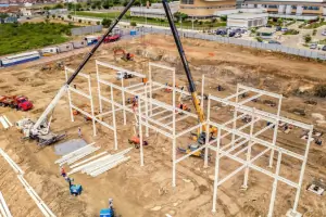
Our site engineering establishes precise control points and gridlines for construction projects. We ensure accurate positioning of structural elements through millimetre-precision setting-out services, supporting seamless project execution from foundation to completion stages.
Measured Building Surveys
We produce accurate building measurements for refurbishment and planning applications. Our surveys include detailed floorplans, elevations, and sections to document existing structures. These records support right-of-light assessments and building development projects with precise dimensional data.
Questions
What surveying services do you offer?
We provide topographical surveys, measured building surveys, 3D laser scanning, drone surveys, site engineering, GPS surveys, volume calculations, and structural monitoring services.
Which areas do you cover?
We operate throughout the South East of England and provide services across the UK mainland for surveying and engineering projects.
What technology do you use?
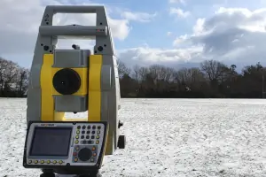
We utilise modern equipment including GNSS receivers, 3D laser scanners, UAV drones, and precision total stations for accurate data collection and analysis.
How quickly do you deliver survey results?
Most projects receive digital deliverables within 5 working days following site completion, with urgent requests accommodated where possible.
Can you handle both small and large projects?
We work on domestic properties, commercial developments, and infrastructure projects, adapting our approach to suit each site's specific requirements.