
Business Details
17 Years
experience
Expert Land Surveying Services in Gloucestershire
Established in 2009, Monument Geomatics brings together a team with over 50 years of combined experience in land surveying and construction. Our expertise spans topographical surveys, measured building surveys, laser scanning, and underground utility detection, serving both private and public sector clients. Located in Gloucestershire, we leverage strategic proximity to major transport links to deliver services across the Midlands, Wales, and the South West. Our commitment to advanced technology, including GPS and 3D visualisation, ensures precise data collection and efficient project delivery. We prioritise client collaboration, tailoring solutions to meet specific budgetary and scheduling requirements while maintaining rigorous quality standards.Our work supports diverse projects, from highways design to asset management, with a focus on accuracy and added-value insights. Recognised by architects and local authorities, we adhere to industry-specific specifications for seamless integration into design systems. Client testimonials highlight our responsiveness, technical flexibility, and competitive pricing. With investments in continuous training and cutting-edge instrumentation, we maintain a reputation for reliability and innovation. Our team's dedication to excellence ensures clients receive actionable data that underpins successful project outcomes.
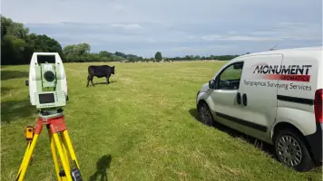
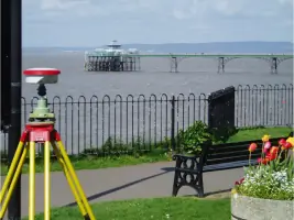
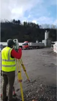
Services
Topographical Surveys
Measured Building Surveys
Laser Scanning
Underground Utility Surveys
Engineering Surveys
3D Visualisation
Deformation Monitoring
Hydrographic Surveys
Details
- Year established: 2009
Highlights and features
- We have over 50 years of combined experience in land surveying.
- We utilise advanced GPS and laser scanning technology.
- Our services are tailored to meet specific project requirements.
- We deliver surveys ahead of schedule with competitive pricing.
- Our team adheres to industry-specific technical specifications.
What people say
Swift and thorough service
High quality deliverables
Competitive price
Technical flexibility
Delivered ahead of schedule
Services
Topographical Surveys
We conduct high-accuracy topographical surveys using total stations, GPS, and digital levels to create detailed terrain models. Our surveys support land development, highways design, and asset management projects. Data is processed with advanced software to produce client-specific outputs including 3D AutoCAD drawings and MX-Moss text files.
Measured Building Surveys
Our measured building surveys produce precise floorplans and elevations using large-scale data acquisition. We create detailed CAD drawings for internal planning and external development evaluation. These 3D models enable accurate measurements and visualisation of complex structures, aiding architectural and engineering projects.
Laser Scanning
We employ terrestrial laser scanning to capture high-resolution spatial data for 3D visualisation. This technology supports deformation monitoring, heritage preservation, and structural analysis. Our scans provide millimetre-accurate datasets for creating digital twins and assessing structural integrity.
Underground Utility Surveys
Our underground utility surveys locate and map buried services using electromagnetic detection and ground-penetrating radar. This prevents costly strikes during excavation and ensures safe site preparation. Surveys are delivered with precise coordinates and depth measurements for integration into project plans.
Engineering Surveys
We provide engineering surveys for infrastructure projects including highways, bridges, and drainage systems. Our services cover setting-out, as-built verification, and deformation monitoring. Using GPS and total stations, we ensure construction works adhere to design specifications and tolerances.
Questions
What surveying services do you offer?
We provide topographical surveys, measured building surveys, laser scanning, underground utility detection, and engineering surveys using advanced GPS and 3D visualisation technology.
Which areas do you cover?
Based in Gloucestershire, we serve the Midlands (Gloucestershire, Herefordshire, Worcestershire, Warwickshire), Wales, and the South West regions.
How experienced is your team?
Our team has over 50 years of combined experience in land surveying and construction, with expertise in both traditional and modern techniques.
Can you handle urgent projects?
Yes, we mobilise quickly when required and have consistently delivered surveys ahead of schedule, even for time-sensitive projects.
What technology do you use?
We utilise high-accuracy total stations, GPS, digital levels, terrestrial laser scanning, and advanced software like LSS and AutoCAD for data processing.
How do you ensure survey accuracy?
We combine advanced instrumentation with rigorous quality control processes, including adherence to client specifications and industry standards for data validation.