
Business Details
39 Years
experience
Professional Land and Building Surveyors in Christchurch, Dorset
Established in 1987, Southern Land Surveys UK is a leading land surveying and measured building company headquartered in Christchurch, Dorset. Led by Andrew West, whose architectural background and decades of industry experience inform our client-focused approach, we deliver precise topographical surveys, measured building surveys, and Land Registry-compliant plans across Bournemouth, Christchurch, and Dorset. Our team combines traditional surveying techniques with cutting-edge technology, including 3D laser scanning, to produce high-quality digital terrain models and scaled drawings.With over 45 years of collective expertise, we serve private individuals and major architectural firms, providing foundational data for construction projects that meet regulatory standards and client specifications. Our commitment to accuracy, competitive pricing, and timely delivery has earned us repeat business and endorsements from industry partners.

Services
Topographical Surveys
Measured Building Surveys
Setting Out
Land Registry Plans
3D Laser Scanning
Details
- Year established: 1987
Highlights and features
- We have over 30 years of experience in land and building surveying.
- Our team uses advanced 3D laser scanning and GPS technology.
- We produce Land Registry-compliant lease plans for legal documentation.
- Flexible delivery options for survey data in digital or printed formats.
- Proven track record with endorsements from architectural firms.
What people say
Competitively priced, reliable and efficient
Excellent and prompt service
Consistently the most competitive on price
Services
Topographical Surveys
We conduct detailed topographical surveys to map terrain features and elevations. Our digital terrain models and contoured plans in 2D or 3D formats support construction, planning, and regulatory compliance. Clients receive accurate CAD drawings for architects, engineers, and building contractors.
Measured Building Surveys
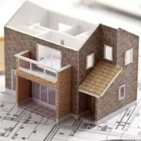
Our measured building surveys produce precise 2D floor plans, elevations, and cross-sections for renovation or legal purposes. Data is delivered on paper, film, or digital media. This service ensures clients have reliable documentation for property assessment and construction projects.
Land Registry Plans
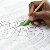
We create scaled lease plans compliant with Land Registry standards for legal documentation. These plans define property boundaries for leases exceeding seven years, ensuring regulatory approval and seamless property transactions for solicitors and legal departments.
3D Laser Scanning
Using 3D laser scanning, we capture detailed object shapes to generate accurate 'point cloud' data. This technology enables efficient extraction of measurements for high-precision survey drawings, enhancing project outcomes for clients in construction and engineering sectors.
Setting Out
We transfer architectural designs to physical sites using GPS and total stations. This service ensures accurate positioning for new builds, working closely with construction teams to maintain project timelines and structural integrity from foundation to completion.
People
Andrew West
Founder
Andrew West founded Southern Land Surveys UK in 1987, leveraging his architectural background and 45+ years of surveying experience. He leads the company's commitment to precision, delivering high-quality surveys for domestic and commercial projects across southern England.
Questions
Do you provide Land Registry compliant plans?
Yes, we specialise in producing Land Registry-compliant lease plans for legal documentation, ensuring regulatory approval for property transactions.
Why is a measured building survey important?
Measured building surveys provide critical data for renovations, construction, and legal documentation, ensuring accurate planning and compliance with project requirements.
What technology do you use for surveys?
We use 3D laser scanning, GPS systems, and CAD software alongside traditional techniques to ensure precision in all surveying projects.
How is survey data delivered?
Data is delivered in 2D format via paper, film, or digital disc, tailored to client preferences for accessibility and integration into their workflows.
Can you handle custom survey requests?
Yes, we offer tailored solutions for unique project needs, including additional documentation and bespoke deliverables to meet client specifications.