Business Details
13 Years
experience
Professional Surveying Services in the UK
At THS Concepts, we specialise in delivering precise and reliable surveying solutions tailored to the needs of architects, engineers, and construction professionals. Established in 2013 by Tom Ayre, our team combines technical expertise with a commitment to client satisfaction, offering services ranging from 3D laser scanning to topographical surveys. With over a decade of experience and a growing team of seven, we have completed thousands of projects across the UK and internationally, including high-profile sites like Wembley Stadium and Bradwell Nuclear Power Station.Our membership with The Survey Association underscores our adherence to industry standards, while our 5-star reviews reflect our dedication to quality and customer service. We prioritise transparency, efficiency, and environmental responsibility, ensuring clients receive accurate data and timely deliverables. Our work supports diverse projects, from heritage building documentation to infrastructure development, enabling informed decision-making and successful project outcomes.
Services
3D Laser Scanning
BIM Modelling
Measured Surveys
Topographical Surveys
Drone Surveys
Monitoring Surveys
Setting Out Surveys
Hydrographic Surveys
Utility Surveys
Building Height Surveys
Details
- Year established: 2013
Highlights and features
- Client-focused approach with tailored solutions for unique project needs
- Rapid project turnaround times without compromising accuracy
- 5-star Google and Trustpilot reviews demonstrating exceptional service
- Environmental initiatives including compostable surveying targets
- Experienced team with over 10 years in surveying and construction sectors
Associations and certifications
- The Survey Association
What people say
Meticulous precision
Quick turnaround
Professional team
Reliable service
Excellent communication
Services
3D Laser Scanning
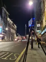
Our 3D laser scanning service captures precise spatial data using FARO technology, creating detailed digital models for architectural and engineering projects. This non-invasive method produces point clouds with 1mm accuracy at 25m range, enabling creation of BIM models, floor plans, and elevation drawings. Ideal for complex structures like heritage buildings and industrial facilities, our scanning supports quality control, design validation, and construction planning while minimising site revisits.
BIM Modelling
We convert survey data into comprehensive BIM models using Autodesk Revit, supporting construction projects from concept to completion. Our LOD 100-400 models include architectural, structural, and MEP elements with embedded asset data for facility management. This digital representation enables clash detection, construction sequencing, and coordinated design across multidisciplinary teams, improving project efficiency and reducing costly errors during implementation.
Measured Surveys
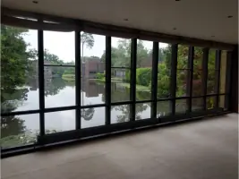
Our measured building surveys provide accurate dimensional records for property refurbishment, lease agreements, and heritage documentation. Using laser technology and traditional methods, we capture floor plans, elevations, and sections with millimetre precision. These surveys support architectural design, space planning, and compliance assessments while maintaining historical accuracy for conservation projects across residential, commercial, and listed buildings.
Topographical Surveys
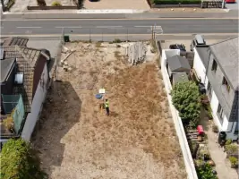
We conduct detailed topographical surveys mapping terrain features, drainage patterns, and existing structures for development projects. Our surveys support infrastructure planning, flood risk assessments, and site grading designs by providing accurate elevation data and surface models. Using GPS and total station equipment, we deliver plans showing spot levels, contours, and above-ground features essential for engineering and construction decision-making.
Monitoring Surveys
Our structural monitoring service tracks building movement and crack development using automated and manual measurement systems. This service supports party wall agreements, underpinning projects, and subsidence assessments by providing documented evidence of structural changes over time. We deliver clear graphical reports showing movement trends, enabling engineers to make informed decisions about remedial works and structural safety.
People
Tom Ayre
Director / Founder
With over a decade in civil engineering and surveying, Tom founded THS Concepts in 2013 after working with Red7Marine. He leads our technical team, ensuring delivery of accurate survey data and CAD drawings while maintaining client relationships across architectural and construction sectors.
Chris Horton
Director
Joining in 2014, Chris brings architectural expertise to our survey team. He manages complex projects and coordinates our technical staff, ensuring seamless integration of survey data with design requirements for both private and public sector clients.
Lesley Castle
Office Manager
Handling our administrative operations since 2019, Lesley ensures smooth project coordination and client communication. Her organisational skills support our rapid quotation process and efficient service delivery across all surveying disciplines.
Questions
What is 3D laser scanning used for?
3D laser scanning creates accurate digital models for architectural design, construction planning, heritage documentation, and infrastructure projects by capturing precise spatial data.
How does BIM modelling benefit construction projects?
BIM modelling improves coordination between design teams, enables clash detection, and provides data-rich models that support construction sequencing and facility management.
What areas do you cover for on-site surveys?
We operate nationwide across the UK and undertake international projects in locations including Liberia, Spain, and France.
Can you produce 2D drawings from existing buildings?
Yes, our measured building surveys generate accurate 2D floor plans, elevations, and sections from existing structures for renovation and lease purposes.
How quickly can you complete a survey project?
Most projects are completed within seven days of site access, with urgent requests accommodated through our flexible scheduling.
Do you provide monitoring for structural movement?
Yes, we offer crack monitoring and structural movement tracking services with regular reporting to support party wall agreements and subsidence assessments.