
Business Details
32 Years
experience
Your Trusted Partner for Architectural Survey Solutions
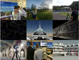
Cadplan Services has been a leader in 2D and 3D measurement solutions since 1994, pioneering the use of 3D laser scanning technology to deliver precise building documentation. Our expertise spans measured building surveys, topographic surveys, and BIM-compliant 3D Revit models, serving commercial, residential, and public sector clients across the UK and internationally. With over 30 years of industry experience, we combine traditional surveying methods with cutting-edge technology to meet evolving client needs. Our team of skilled professionals specialises in underground utility surveys, rights of light assessments, and aerial inspections, ensuring comprehensive data capture for construction, refurbishment, and facilities management projects.We maintain a strong reputation for accuracy, reliability, and timely delivery, supported by long-standing relationships with architects, contractors, and property owners. Our commitment to adopting innovative hardware and software solutions ensures clients receive detailed, actionable insights for complex projects. By focusing on quality output and client collaboration, we address challenges in commercial, retail, and heritage sectors while maintaining industry-leading standards.
Services
3D Laser Scanning
Measured Building Surveys
Topographic Surveys
3D Revit Models
Underground Utility Surveys
Rights of Light Surveys
Details
- Year established: 1994
Highlights and features
- We have 30 years of experience in architectural surveying and BIM solutions.
- We utilise advanced 3D laser scanning technology for accurate data capture.
- Our team delivers tailored solutions for commercial, residential, and heritage projects.
- We maintain ISO 9001 standards for quality management in surveying services.
- We provide timely, budget-conscious deliverables for complex construction challenges.
Services
3D Laser Scanning
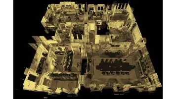
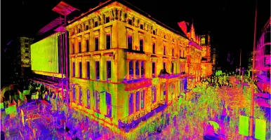
3D laser scanning captures precise spatial data using time-of-flight and phase-based technologies. This non-invasive method reduces site visits while ensuring millimetre accuracy for complex structures. Clients receive detailed point cloud datasets for architectural analysis, construction planning, and heritage preservation projects.
Measured Building Surveys
Measured building surveys produce detailed floor plans, elevations, and sections using traditional and digital methods. These surveys support refurbishment, space planning, and compliance assessments. Deliverables include CAD drawings and BIM-ready models for commercial and residential properties.
Topographic Surveys
Topographic surveys map terrain features and surface details for land development projects. Using GPS and total station equipment, we create contour plans and digital terrain models. These surveys support infrastructure planning, drainage analysis, and environmental impact assessments.
3D Revit Models
3D Revit models convert survey data into intelligent BIM components for construction projects. These models integrate with architectural and engineering designs, enabling clash detection and construction sequencing. Clients benefit from improved project coordination and lifecycle management.
Underground Utility Surveys
Underground utility surveys locate and map buried services using electromagnetic detection and GPR technology. This prevents costly damages during excavation works. Deliverables include GIS-compatible datasets and risk assessment reports for safe site development.
People
Gareth Edwards
Director
Gareth Edwards founded Cadplan Services in 1994 and has led its adoption of 3D scanning technology. With 30 years of surveying experience, he oversees project delivery and technical innovation for architectural clients.
Colin Dunlop
Survey Manager
Colin Dunlop manages survey operations and technical implementation of laser scanning projects. His expertise in data capture and BIM integration ensures accurate deliverables for complex construction schemes.
Mark Rosier
Cost Manager
Mark Rosier handles financial planning and lease plan production. He provides cost-effective survey solutions for property owners and legal professionals across London and the South East.
Questions
What surveying technologies does Cadplan Services use?
We use 3D laser scanning, total station surveying, and GIS mapping technologies to deliver accurate spatial data for architectural and construction projects.
Do you work on heritage building projects?
Yes, we specialise in surveying historic buildings using non-invasive techniques to preserve architectural details while supporting restoration and conservation efforts.
Can you provide BIM-compliant deliverables?
Yes, we create Revit models and point cloud datasets that integrate with BIM workflows for construction coordination and facility management.
What areas do you cover?
We operate nationwide across the UK and undertake international projects for commercial, residential, and public sector clients.
How quickly can you complete a survey?
Project timelines vary by scope, but we prioritise efficient data capture and typically deliver survey reports within agreed deadlines for your project needs.
Videos