
Business Details
Expert Surveying and Engineering Services in Sudbury
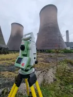
Established for over 50 years, South Staffs Surveys has built a reputation as a trusted provider of comprehensive surveying and engineering services across the United Kingdom. Our expertise spans measured building surveys, utility mapping, bathymetric assessments, and site design solutions, tailored to meet the precise needs of clients in both public and private sectors. With a dedicated team of professionals, we combine advanced technology and traditional methodologies to deliver accurate data and actionable insights. Our commitment to quality is reflected in our meticulous approach to earthworks planning, volume calculations, and 3D modelling, ensuring optimal material management for construction and infrastructure projects. We prioritise client collaboration, providing detailed reports, visualisations, and technical drawings that support informed decision-making.Backed by decades of experience in challenging environmentsfrom urban developments to waterway assessmentswe remain at the forefront of surveying innovation. Our services extend to landfill management, quarry planning, and civil engineering projects, where precision and efficiency are paramount. By maintaining rigorous standards in data collection and analysis, we empower clients to achieve cost-effective, sustainable outcomes. As a family-run business with deep industry roots, we blend technical excellence with personalised service, ensuring every project benefits from our accumulated knowledge and client-centric ethos.
Services
Measured Building Surveying
Utility Surveying
Bathymetric Surveying
Site Design
Volume Calculations
Highlights and features
- We have over 50 years of experience in surveying and engineering services.
- Our team specialises in 3D modelling and accurate volume calculations.
- We provide tailored solutions for construction, infrastructure, and environmental projects.
- Our services ensure efficient material management and cost-effective outcomes.
- We combine advanced technology with traditional methodologies for precision data.
Services
Measured Building Surveying
We produce detailed floor plans, elevations, and sections using advanced surveying techniques. Our services cater to architects, developers, and property managers requiring precise structural data. This ensures accurate planning and compliance for renovation or documentation projects.
Bathymetric Surveying
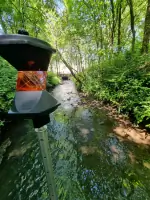
We conduct accurate river, canal, and lake bed assessments using radio-controlled or manned boats. This service supports environmental monitoring, flood risk analysis, and dredging operations. Clients benefit from detailed depth measurements and sediment analysis.
Utility Surveying
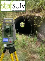
We provide non-intrusive surveys to map underground utilities like water, gas, and electrical networks. This ensures safe excavation planning and infrastructure maintenance. Our methods include ground-penetrating radar and electromagnetic detection.
Site Design
We create 3D ground models and phasing plans for construction sites, optimising material usage and reducing costs. This service supports landfill management, quarry planning, and civil engineering projects with precise design solutions.
Volume Calculations
We calculate cut-and-fill quantities for construction sites, ensuring efficient material handling and cost savings. Our reports include isopachyte maps and shaded plots to visualise earthworks requirements for large-scale developments.
Questions
What surveying services do you offer?
We provide measured building surveys, utility mapping, bathymetric assessments, site design, and volume calculations for construction and infrastructure projects.
How do you ensure survey accuracy?
We use advanced 3D modelling, radio-controlled boats, and non-intrusive detection methods to guarantee precise data collection and analysis.
Do you work outside the UK?
Our primary focus is the UK, but we can discuss international projects on a case-by-case basis.
Can you assist with earthworks planning?
Yes, we specialise in cut-and-fill strategies, material management, and phasing plans to optimise construction site efficiency.
How do you present survey results?
We deliver detailed reports, CAD drawings, isopachyte maps, and 3D visualisations to clarify site conditions and design proposals.
What industries do you serve?
We support construction, civil engineering, environmental, and infrastructure sectors with tailored surveying and engineering solutions.