Business Details
49 Years
experience
Expert Land Surveying Services in South Wales
Established in 1977, John Vincent Surveys (JVS) has built a reputation for precision and reliability in land, hydrographical, and building surveying. Our senior management team, with over 30 years of collective experience, leads a dedicated workforce committed to delivering high-quality services across South Wales and nationwide. Certified to ISO 9001 standards, we utilise cutting-edge Trimble and Leica equipment to meet exacting tolerances for clients in civil engineering, construction, and geotechnical sectors. Our expertise spans feasibility studies, construction monitoring, and as-built surveys, supported by advanced GPS and CAD technologies. We prioritise client-specific requirements, offering digital and paper deliverables tailored to project needs.With a focus on innovation, our team provides rapid, accurate data collection through remote monitoring, volumetric measurement, and setting-out services. Our directors, Paul Owen and Andrew Williams, bring decades of technical proficiency, ensuring every project adheres to rigorous quality assurance protocols. JVS serves diverse industries, including water, leisure, and architectural sectors, maintaining a legacy of excellence since our formation as a limited company in 1991. Our commitment to professional service is reflected in our nationwide client base and long-standing industry partnerships. By integrating traditional surveying methods with modern GPS solutions, we deliver cost-effective, precise results for projects of all scales.

Services
Topographic Surveys
Building Surveys
Deformation Monitoring
GPS Surveys
Volumetric Measurement
Setting Out
Digital Mapping
Details
- Year established: 1977
Highlights and features
- We have over 30 years of combined experience in senior management roles.
- Our ISO 9001 certification ensures rigorous quality assurance standards.
- We utilise state-of-the-art Trimble and Leica surveying equipment.
- We serve clients nationwide with tailored surveying solutions.
- Our GPS systems achieve accuracies of up to 5mm in x, y coordinates.
Associations and certifications
- ISO 9001
Services
Topographic Surveys
Our topographic surveys utilise advanced Trimble Total Stations and Leica GPS systems to capture precise terrain data. This service supports civil engineering and construction projects by providing detailed elevation models and feature mapping. Delivered in digital or paper formats, our surveys meet industry standards for accuracy and are compatible with CAD software.
Deformation Monitoring
We monitor building deformation and subsidence using high-accuracy electronic distance measurement (EDM) equipment. This service detects 2D/3D movements in structures or landscapes, providing critical data for geotechnical assessments. Remote monitoring capabilities ensure safety and precision in inaccessible areas.
GPS Surveys
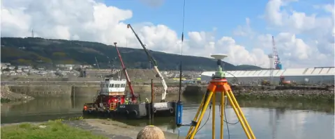
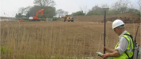
Our GPS surveys achieve 5mm accuracy in x, y coordinates using Leica Smartnet technology. This service provides rapid geodetic referencing for large-scale projects, with mobile setups enabling efficient coverage of open areas. Data integrates seamlessly with national grid systems.
Volumetric Measurement
We calculate bulk earthwork volumes through combined EDM and GPS data, processed via CAD systems. This service delivers rapid, accurate quantity assessments for construction and mining projects, with outputs in industry-standard formats like AutoCAD DXF.
Setting Out
Our setting-out service guides construction projects nationwide using digital data transfer to field equipment. This ensures precise placement of infrastructure elements for building sites, pipelines, and utilities, minimising errors through direct file integration.
People
Paul Owen
Director/Land Surveyor
With HNC qualifications and MCInstCES membership, Paul has directed JVS's survey operations for over a decade, ensuring technical excellence and client satisfaction across complex projects.
Andrew Williams
Director/Land Surveyor
Andrew's HNC-qualified expertise spans 10+ years as a JVS director, managing nationwide surveying projects and maintaining ISO 9001 compliance standards for quality assurance.
Michael Powell
Land Surveyor
HNC-qualified Michael contributes to JVS's field operations with 15+ years of experience in precision land surveying techniques and equipment management.
Rhys Jackson
Land Surveyor
NVQ Level 3-certified Rhys specialises in GPS surveying systems, supporting JVS's rapid data collection capabilities for large-scale infrastructure projects.
Kyle Peart
Graduate Land Surveyor
Kyle's BSc Hons degree underpins his role in JVS's next-generation surveying team, integrating digital mapping technologies with traditional field methods.
Questions
What surveying technologies does JVS use?
We use Trimble Total Stations, Leica GPS systems, and Smartnet technology for accuracies up to 5mm in x, y coordinates.
Do you provide nationwide services?
Yes, our surveying services extend across South Wales and throughout the UK for all project types.
How does deformation monitoring work?
We use high-accuracy EDM equipment to detect 2D/3D structural movements, with remote monitoring options for inaccessible areas.
What formats do you provide survey data in?
We deliver surveys in digital formats including AutoCAD DXF, DWG, and MX Genio, plus paper outputs.
Are your services ISO-certified?
Yes, we maintain ISO 9001 certification for quality assurance across all our surveying operations.
How quickly can you complete a survey?
Our GPS systems enable rapid data collection, with typical projects completed within agreed timelines per client specifications.