
Business Details
22 Years
experience
Professional Land & Building Surveying Services in Belper
Established in 2004, Landtech Surveys has built a reputation as a trusted provider of professional land and building surveying services across the UK. Our expertise lies in delivering precise measurements and detailed mapping of land and structures, utilising cutting-edge technology such as laser scanning and drone surveys. We specialise in topographic surveys, boundary determinations, and measured building surveys, ensuring accuracy for construction, property development, and legal purposes. Our team of experienced surveyors combines technical proficiency with a commitment to client satisfaction, offering tailored solutions to meet individual project requirements. We prioritise reliability and integrity, maintaining a focus on innovation to enhance data collection efficiency.With two decades of operational experience, we have become a go-to partner for clients seeking expert surveying support. Our dedication to excellence is reflected in our use of advanced equipment, including robotic total stations and GNSS receivers, which enable high-precision results. We serve both private and commercial clients, providing comprehensive documentation for land registry submissions and infrastructure projects. Our working hours are structured to accommodate client needs, operating Monday to Friday from 8am to 6pm. As a company registered with Companies House under number 07533607, we uphold professional standards while maintaining transparency in all our services.

Services
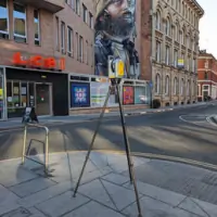
Topographic Surveys
Measured Building Surveys
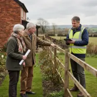
Boundary Surveys
Laser Scanning
Drone Surveys
Details
- Year established: 2004
Highlights and features
- We have over 20 years of experience in professional land surveying.
- Our team uses state-of-the-art equipment for accurate data collection.
- We provide tailored surveying solutions for specific project requirements.
- Our commitment to reliability ensures legally sound boundary determinations.
- We prioritise customer satisfaction with prompt and professional service.
What people say
Excellent service
Prompt and professional
Accurate survey results
Services
Topographic Surveys
Topographic surveys measure natural and man-made features of the land, including elevations, contours, and structures. This data creates detailed maps for construction and development projects. Our use of drones and laser scanning ensures high accuracy and efficiency.
Measured Building Surveys
Measured building surveys produce scaled drawings of existing structures, including floorplans, elevations, and sections. These surveys are essential for renovations, extensions, or asset management. Our team uses advanced tools to guarantee precise measurements and comprehensive documentation.
Boundary Surveys
Boundary surveys establish legal property lines, corners, and easements to resolve disputes or prepare land registry submissions. Our expertise ensures compliance with legal standards, providing clients with reliable documentation for ownership clarity.
Laser Scanning
Laser scanning captures detailed 3D data of physical environments, enabling precise digital replicas. This technology accelerates data collection for complex sites, supporting engineering and architectural projects with high-resolution spatial information.
Drone Surveys
Drone surveys use UAVs to collect aerial imagery and topographic data over large or inaccessible areas. This method reduces time and costs while maintaining accuracy, ideal for site analysis, progress monitoring, and volumetric calculations.
Questions
What surveying services do you offer?
We provide topographic surveys, measured building surveys, boundary surveys, laser scanning, and drone surveys for residential and commercial projects.
How do you ensure survey accuracy?
We use advanced equipment like robotic total stations, GNSS receivers, and laser scanners to guarantee precise measurements and reliable data.
Can you handle urgent survey requests?
We prioritise timely service but recommend contacting us early to schedule urgent projects within our working hours.
Do you operate outside Derbyshire?
While based in Belper, we conduct surveys across the UK, utilising technology to serve diverse locations efficiently.
How do I receive survey results?
Deliverables include detailed digital maps, 3D models, and reports sent via email or secure file transfer for easy access and integration.