Business Details
Expert Surveying Services in Alcester, Warwickshire
Grantham Coates Surveys provide a comprehensive range of land, rail, river, engineering, and measured building surveying services. Established by industry professionals John Grantham and Chris Coates, our team of experienced surveyors delivers high-quality, tailored spatial data solutions to meet exact client requirements. With membership in the Chartered Institution of Civil Engineering Surveyors and full membership of The Survey Association, we maintain rigorous professional standards.Our Midlands-based location ensures nationwide accessibility while our international projects demonstrate global capability. We prioritise client satisfaction through precise deliverables, adherence to deadlines, and direct communication between surveyors and clients throughout the project lifecycle. Our investment in advanced survey technology and staff development ensures consistent quality and efficiency across all survey types.

Services
Drone Surveys
Topographical Surveys
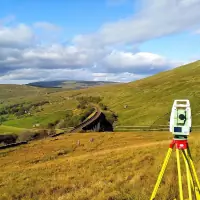
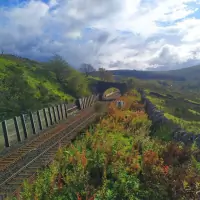
Railway Surveys
River Surveys
Measured Building Surveys
Laser Scanning
Sub-Station Surveys
Highlights and features
- We provide tailored survey solutions developed by experienced professionals
- Our surveyors process data directly, ensuring site knowledge continuity
- We maintain industry-leading equipment calibration and technology standards
- Our team holds specialist safety certifications including Confined Spaces and First Aid
- We guarantee timely delivery of CAD-ready survey data for immediate use
Associations and certifications
- Chartered Institution of Civil Engineering Surveyors
- The Survey Association
What people say
High quality product
Professional manner
Exceed needs
Timely delivery
CAD technicians prefer format
Services
Topographical Surveys
Our topographical surveys capture detailed terrain features and elevations using advanced surveying equipment. This service provides accurate digital mapping for construction planning, land development, and environmental assessments. Surveyors maintain direct control from fieldwork to data processing, ensuring precision and contextual understanding throughout the project lifecycle.
Drone Surveys
We utilise drone technology for high-resolution aerial mapping and 3D modelling. This service offers cost-effective data collection for large areas, infrastructure inspections, and progress monitoring. Our certified operators ensure compliance with aviation regulations while delivering georeferenced imagery and point cloud data for engineering applications.
Measured Building Surveys
Our measured building surveys produce precise architectural drawings and BIM-ready models of existing structures. This service supports renovation projects, heritage conservation, and facilities management. We combine laser scanning with traditional survey methods to capture intricate architectural details and structural elements accurately.
Railway Surveys
Specialist railway surveys provide track geometry measurements and infrastructure assessments for network maintenance. Our team works within live rail environments following strict safety protocols. Deliverables include track alignment data, clearance profiles, and asset condition reports for Network Rail compliance.
Laser Scanning
High-definition laser scanning captures millions of data points to create detailed 3D models of complex environments. This service supports heritage preservation, industrial plant surveys, and structural analysis. Our equipment achieves millimetre accuracy while minimising site visit durations through efficient data capture.
People
John Grantham
Founder
Co-founder with extensive surveying experience, known for technical expertise and client-focused approach. Instrumental in establishing company standards for precision and service delivery.
Chris Coates
Founder
Co-founder bringing specialist knowledge in engineering surveys and project management. Maintains active involvement in technical development and quality assurance processes.
Questions
What survey types do you specialise in?
We specialise in topographical, railway, river, measured building, drone, laser scanning, and sub-station surveys using advanced surveying technology.
Do you work outside the UK?
Yes, we undertake international projects including European historic building laser scanning while maintaining our Midlands-based UK operations.
How do you ensure survey accuracy?
Through direct surveyor control from fieldwork to data processing, regular equipment calibration, and staff with specialist safety certifications.
What deliverables can I expect?
We provide industry-standard digital drawings, CAD files, and 3D models tailored to your specific project requirements for immediate use.
How quickly can you complete surveys?
We prioritise timely delivery through efficient data collection processes and direct surveyor processing, ensuring prompt turnaround without compromising quality.
Videos