
Business Details
31 Years
experience
Chartered Land Surveyors in Wellington, Somerset
Established in 1995, Lewis Brown Chartered Land Surveyors has built a reputation for delivering precise, timely, and high-quality spatial data. Our team combines over 25 years of collective surveying experience with cutting-edge technology, including robotic total stations, laser scanners, and drones, to meet diverse client needs. As RICS-chartered professionals and members of The Survey Association, we prioritise collaboration, quality, communication, and timely delivery.Our core values ensure clients receive fit-for-purpose data tailored to their exact requirements, supported by a commitment to investing in both personnel and equipment. Operating nationwide from our Somerset headquarters, we serve a range of sectors with expertise in topographical surveys, measured building surveys, and engineering setting-out.
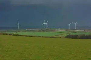

Services
Topographical Surveys
Measured Building Surveys
Control & Monitoring Surveys
Watercourse & Coastal Surveys
Engineering & Setting Out
Drainage & Utility Surveys
Details
- Year established: 1995
Highlights and features
- We offer 25+ years of RICS-accredited surveying expertise.
- Our team utilises advanced equipment like laser scanners and drones.
- We are members of The Survey Association, ensuring industry-leading standards.
- A collaborative approach guarantees client-specific, fit-for-purpose data.
- Timely delivery supported by investment in personnel and technology.
Associations and certifications
- Royal Institution of Chartered Surveyors (RICS)
- The Survey Association
Services
Topographical Surveys
Using robotic total stations, GPS, and laser scanners, we create detailed 3D models and maps of land features. This data supports infrastructure projects, planning applications, and environmental assessments. Clients benefit from accurate, format-flexible outputs for informed decision-making.
Measured Building Surveys
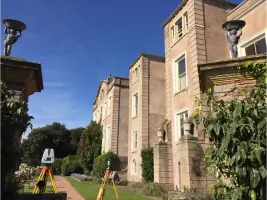
Laser scanning captures complex building geometries with minimal disruption. Deliverables include floor plans, elevations, and 3D models for renovations, extensions, or asset management. Our technology ensures precision for operational or heritage structures.
Engineering & Setting Out
We provide precise coordinates for drainage systems, road alignments, and construction plots. This ensures projects adhere to design specifications, reducing rework risks. Clients gain confidence in accurate on-site implementation.
Drainage & Utility Surveys
Using ground-penetrating radar and electromagnetic tracing, we map subsurface utilities. This prevents damage during excavations and supports infrastructure planning. Clients receive layered data integrating with topographical surveys.
Watercourse & Coastal Surveys
We monitor embankments and underwater features using multi-beam sonar and GPS. Data informs flood risk management and coastal defence projects. Clients rely on repeatable, high-precision measurements for long-term planning.
People
Rob Brown
Founder
With 26 years of surveying experience, Rob founded the company in 1995. He oversees strategic direction and technical standards, ensuring adherence to RICS guidelines while fostering client relationships.
Mark Land
Land Surveyor
An 18-year veteran, Mark specialises in measured building surveys. He joined in 2007, leveraging expertise in laser scanning to deliver detailed architectural models for commercial and heritage projects.
Dave Smith
Assistant Surveyor
Dave has 18 years of field experience, supporting infrastructure projects with topographical data collection. He joined in 1999, focusing on engineering surveys and utility mapping.
Marc Ellis
Surveyor
Rejoining in 2016 after industry breaks, Marc brings 15 years of expertise in land and building surveys. He specialises in integrating drone data with traditional survey methods for large-scale sites.
Steve Jones
Senior Surveyor
With 16 years at the firm, Steve leads complex measured building projects. His focus on accuracy and client collaboration ensures deliverables meet tight deadlines without compromising quality.
Questions
What services do Lewis Brown offer?
We provide topographical surveys, measured building surveys, engineering setting-out, drainage/utility mapping, and watercourse monitoring using advanced technologies like laser scanners and drones.
How experienced is your team?
Our surveyors have 15–26 years of experience, supported by RICS chartered status and membership in The Survey Association for industry-leading standards.
Are you RICS-accredited?
Yes, we are RICS-chartered surveyors, ensuring all services meet rigorous professional and technical benchmarks for accuracy and reliability.
Which areas do you cover?
While based in Somerset, we operate nationwide across the UK for both public and private sector projects.
Videos