Business Details
Your Trusted Surveying and Engineering Partner in the UK
Geomatic Surveys was established over a decade ago to deliver comprehensive surveying and engineering solutions. Our expertise spans topographical surveys, measured building surveys, engineering services, flood risk assessments, and 3D laser scanning. We serve a diverse clientele, including multinational organisations, national house builders, architects, and local government bodies. Our team utilises cutting-edge technology such as robotic total stations, GPS systems, and 3D laser scanners to ensure precision and efficiency. With extensive experience across Cheshire, Lancashire, Staffordshire, and nationwide, we provide tailored solutions for complex projects.All surveys undergo rigorous quality assurance checks, and we maintain full professional indemnity and employers' liability insurance. Our surveyors hold CSCS qualifications, reflecting our commitment to safety and industry standards. Clients consistently return due to our reliability, technical expertise, and dedication to delivering accurate, cost-effective results. We prioritise client collaboration, offering CAD checkplots and quality assurance files to support informed decision-making. Our long-standing partnerships with industry leaders like Trimble ensure access to advanced instrumentation and methodologies.
Services
Topographical Surveys
Measured Building Surveys
Engineering Services
Flood Risk Assessments
3D Laser Scanning
Highways Surveys
Highlights and features
- We have over 10 years of experience in land surveying and engineering consultancy.
- Our team utilises modern technology like 3D laser scanners and GPS systems.
- All surveyors hold Construction Skills Certification Scheme (CSCS) qualifications.
- We provide tailored solutions for complex projects across diverse sectors.
- Clients return due to our rigorous quality assurance and competitive pricing.
Services
Topographical Surveys
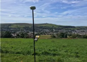
We conduct detailed topographical surveys at all scales, tailored to client needs. Our services include mapping terrain, boundaries, and infrastructure for planning and development projects. Utilising advanced GPS and robotic technology ensures high accuracy and efficiency.
3D Laser Scanning
Our 3D laser scanning captures precise building and site data, creating point cloud datasets and 3D models. This technology accelerates surveying for complex structures, providing invaluable insights for construction and heritage projects across the UK.
Engineering Services
We deliver engineering support for residential, commercial, and industrial developments. Services include stakeout point determination, quality assurance checks, and as-built surveys compliant with Section 38 and 104 submissions for local authorities.
Flood Risk Assessments
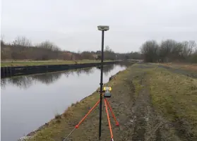
We produce flood risk assessment surveys for planning applications in high-risk areas. Our cross-sectional watercourse surveys and digital terrain models support Environment Agency submissions, ensuring compliance and mitigation strategies.
Measured Building Surveys
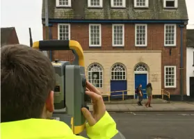
We create accurate 'as-built' drawings for residential to industrial properties. Our surveys document internal and external features, supporting renovations, extensions, or asset management with detailed floor plans and elevations.
People
Ian Holmes
Managing Director
Ian Holmes leads Geomatic Surveys with over a decade of experience in land surveying and engineering consultancy. He oversees project delivery, client relations, and strategic growth, ensuring technical excellence and adherence to industry standards.
Questions
What services does Geomatic Surveys offer?
We provide topographical surveys, 3D laser scanning, engineering services, flood risk assessments, and measured building surveys for residential, commercial, and infrastructure projects.
Which areas do you cover?
We operate throughout the North West and across the UK, serving clients in Cheshire, Lancashire, Staffordshire, and beyond.
How experienced is your team?
Our surveyors and engineers have over 10 years of combined experience, with CSCS qualifications and expertise in modern surveying technologies.
What technology do you use?
We utilise robotic total stations, GPS systems, Trimble SX10 scanning total stations, and 3D laser scanning to ensure precision and efficiency.
How do you ensure quality?
All surveys undergo rigorous quality assurance checks, with CAD checkplots and QA files provided to clients for transparency and accuracy.