Business Details
29 Years
experience
Expert Land Surveyors in Alton, Hampshire
The Meon Survey Partnership is a specialist land and measured building survey company established in 1997, serving clients across the United Kingdom and internationally. Our expertise spans topographic surveys, measured building surveys, laser scanning, 3D modelling, photogrammetry, and aerial surveying using UAV technology. We prioritise accuracy and quality, adhering to RICS Specification Guidelines and English Heritage's Metric Survey Specifications.Our team utilises advanced instrumentation and software, including Autodesk products and Leica scanners, to deliver tailored solutions for complex projects. With a focus on client collaboration, we ensure specifications are agreed upon and maintained throughout projects, supported by RICS-compliant professional indemnity insurance. Our staff are fully trained and experienced, avoiding outsourcing to guarantee consistent quality and reliability.
Services
Measured Building Surveys
Topographic Surveys
Laser Scanning
3D Modelling
Aerial Surveys
Photogrammetry
BIM Services
Virtual Tours
Control Schemes
Monitoring Surveys
Details
- Year established: 1997
Highlights and features
- We carry relevant insurances including RICS-compliant Professional Indemnity Insurance.
- We use tried and tested survey techniques to ensure accuracy and reliability.
- We provide tailored specifications agreed upon with clients before project commencement.
- All staff are trained and experienced; we do not outsource work to third parties.
- We fully control measured surveys for precision, avoiding software assumptions.
Associations and certifications
- RICS
What people say
High quality
Efficient service
Friendly, trustworthy
Helpful and organised
Services
Measured Building Surveys
Measured building surveys provide detailed floor plans, elevations, and 3D models of structures. Our surveys are fully controlled for accuracy, avoiding software assumptions about verticality or angles. Clients receive clear, precise data for refurbishment, planning, or heritage conservation projects.
Laser Scanning
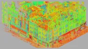
High-definition laser scanning captures millions of data points to create precise 3D 'point clouds'. We use Leica BLK360 and P-series scanners for detailed building analysis, heritage documentation, or industrial applications. Data can be converted into BIM models or used for volume calculations and structural monitoring.
3D Modelling
We produce 3D models from survey data or laser scans, compatible with Revit, AutoCAD, and SketchUp. Models include wireframes, solid formats, and textured surfaces for rights-of-light studies, construction planning, or visualisation. Our team ensures compatibility with client software requirements.
Aerial Surveys
UAV-based aerial surveys capture high-resolution imagery and 3D data for inaccessible areas. Applications include roof inspections, quarry volume calculations, and topographic mapping. Drone data integrates with terrestrial surveys for comprehensive site analysis and visualisation.
Photogrammetry
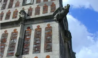
Photogrammetry creates 3D models from high-resolution photographs. We use DSLR cameras and control points to generate rectified imagery for historic facades, artefact documentation, or virtual tours. This method complements laser scanning for detailed visual records.
People
Robert Garne
Survey Technical, Health & Safety
Robert Garne oversees technical survey operations and health & safety compliance. With extensive experience in land surveying, he ensures projects meet rigorous accuracy standards while maintaining safe working practices across diverse sites.
Stephen Harding
Company Secretary & CAD Technical
Stephen Harding manages CAD operations and administrative oversight. His expertise in technical software and survey data processing ensures efficient delivery of complex 3D models and documentation for clients.
Questions
What areas do you serve?
We operate throughout the UK and internationally, with a focus on London, the South of England, and overseas projects requiring specialist surveying.
What survey technologies do you use?
We employ total stations, Leica laser scanners, UAVs/drones, photogrammetry, and Autodesk software to ensure accurate, efficient data collection and modelling.
Are your staff qualified?
All staff are fully trained and experienced in surveying techniques. We do not use agency staff or outsource work to third parties.
Can you handle heritage projects?
Yes, we specialise in historic building surveys, including detailed laser scanning and photogrammetry for conservation and restoration purposes.
Do you provide BIM models?
Yes, we create Revit and other BIM-compatible models from survey data, supporting construction and infrastructure projects with precise digital representations.
What insurance do you hold?
We maintain RICS-compliant Professional Indemnity Insurance and adhere to industry standards for project accountability and client protection.