Business Details
43 Years
experience
Professional Land Surveying Services in London & Yorkshire
Established in 1983, Sterling Surveys provides professional land surveying services, specialising in topographic, architectural, and engineering surveys. As an independent, staff-owned company, we operate across the United Kingdom and internationally from offices in London and Yorkshire. Our team comprises qualified professionals who deliver projects directly without reliance on freelance or agency personnel, ensuring consistent quality and accountability. We adhere to rigorous standards through RICS regulation and SSIP accreditation, prioritising health and safety in all operations. With extensive experience in managing complex domestic and overseas projects, we utilise advanced survey equipment and methodologies to meet diverse client requirements.Our commitment to innovation is evident in services like 3D laser scanning and verified views, which enhance data accuracy and project outcomes. We maintain transparency in processes, providing clients with reliable, CPR35-compliant reports and expert witness testimony where needed. Our long-standing reputation is built on delivering precise, tailored solutions for over four decades, supported by a deep understanding of industry-specific challenges and regulatory frameworks.
Services
Topographic Surveys
Boundary Disputes
Measured Building Surveys
3D Laser Scanning
Verified Views (VVM)
Setting-Out Services
Hydropgraphic Surveys
Railway Surveys
Monitoring Services
Photogrammetry
Details
- Year established: 1983
Highlights and features
- We are an independent, staff-owned company with direct project accountability.
- Our team holds RICS accreditation and follows SSIP health and safety standards.
- We exclusively use in-house professionals, avoiding freelance or agency personnel.
- We have extensive experience managing complex international surveying projects.
- Our verified views data has supported planning inquiries for 15+ years.
Associations and certifications
- RICS
- SMAS
- RISQS
Services
Topographic Surveys
We conduct detailed topographic surveys capturing natural and man-made features for construction, drainage, and landscaping projects. Our data includes spot levels, contours, and features like buildings, roads, and vegetation. Deliverables are provided as 2D DWG files or 3D models compatible with BIM software.
Boundary Disputes
Our RICS-accredited experts resolve boundary conflicts through accurate site surveys and CPR35-compliant reports. We analyse documentary, physical, and photographic evidence to produce court-admissible plans showing historical and current boundary lines. We have provided over 400 expert witness reports in the last 15 years.
3D Laser Scanning
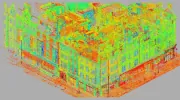
We use high-definition laser scanning to create precise 3D point clouds of structures. This method eliminates accessibility and safety challenges while providing detailed data for BIM applications. Point clouds can be converted into traditional survey drawings or used for advanced structural analysis.
Measured Building Surveys
We produce detailed floor plans, elevations, and sections of buildings ranging from historic cathedrals to modern infrastructure. Our surveys include fixtures, fittings, and architectural details, delivered as 2D CAD files or paper drawings with optional 3D data for complex projects.
Verified Views (VVM)
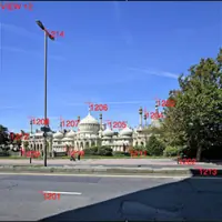
We supply accurate survey data for verified views that depict proposed developments in their surroundings. These images support planning inquiries and have been used in over 15 years of projects. Our data ensures compliance with planning authority requirements for visual impact assessments.
Questions
What surveying services does Sterling Surveys offer?
We provide topographic surveys, boundary dispute resolution, measured building surveys, 3D laser scanning, verified views, railway/highway surveys, and hydropgraphic surveys.
Are your surveyors qualified and accredited?
Yes, we are RICS-regulated, SSIP-accredited via SMAS, and hold RISQS verification. Our staff have professional qualifications and PTS/CSCS certifications.
Can you handle international surveying projects?
Yes, we operate globally from offices in London and Yorkshire, with extensive experience managing overseas projects for over four decades.
How do you ensure survey accuracy?
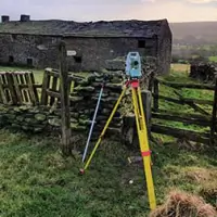
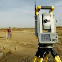
We use advanced equipment like robotic total stations, GPS, and 3D laser scanners. All work is conducted by in-house professionals without freelance personnel.