
Business Details
35 Years
experience
Professional Land Survey Services
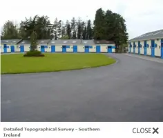
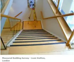
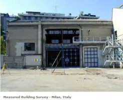
Established in 1991, Hampshire Land Surveys has built a reputation for delivering high-quality, accurate surveying solutions tailored to client specifications. Our team of skilled surveyors utilises the latest Leica equipment, ensuring precision across all projects from initial data collection to final output. With expertise spanning topographical and building surveys, we cater to both small and large-scale developments domestically and internationally, including projects in Italy, Austria, France, and Southern Ireland. Our in-house CAD suite provides full control over survey presentation, allowing customised formatting to meet individual client needs. Notable projects include high-profile locations such as Sloane Street, Bond Street, and Piccadilly in the City of London.We prioritise client collaboration, offering detailed specifications and scalable solutions, from basic topographical surveys to comprehensive garden assessments. Our commitment to technical excellence is complemented by a focus on clear communication and reliability, ensuring client requirements are consistently met. High-definition laser scanning services further enhance our capability to deliver detailed, actionable data. With decades of experience and a track record of successful partnerships, including with Portsmouth City Council, we remain dedicated to advancing surveying standards while maintaining a client-centric approach.
Services
Topographical Surveys
Building Surveys
High Definition Laser Scanning
Measured Surveys
CAD Services
Details
- Year established: 1991
Highlights and features
- We have over 30 years of experience in land and building surveying.
- Our team uses the latest Leica surveying equipment for maximum accuracy.
- We operate internationally, with projects completed in Europe and Ireland.
- Our in-house CAD suite ensures full control over survey presentation and quality.
- We provide tailored specifications to meet exact client requirements.
What people say
Excellent job
Abundance of information
High quality product
Accurate specifications
Tailored approach
Services
Topographical Surveys
We conduct detailed topographical surveys to map terrain features, boundaries, and elevations. Our surveys support planning applications, construction projects, and land management. Using advanced Leica equipment, we ensure high accuracy for both small and large-scale developments.
Building Surveys
Our building surveys produce precise floor plans, elevations, and sections for residential and commercial properties. These surveys aid in renovations, extensions, and compliance checks. Tailored specifications ensure data meets architectural and engineering requirements.
High Definition Laser Scanning
We utilise high-definition laser scanning to capture detailed 3D models of structures and landscapes. This technology enables rapid data collection for complex projects, improving accuracy in design and analysis for clients across multiple sectors.
Measured Surveys
Measured surveys provide exact dimensional data for existing buildings and sites. Our services support architectural plans, BIM integration, and heritage conservation. Customisable output formats ensure compatibility with client workflows.
CAD Services
Our in-house CAD team converts survey data into clear, scalable drawings. Clients receive customised digital and printed outputs, including contour maps and tree canopy details. Full control ensures alignment with project-specific needs.
Questions
What types of surveys do you offer?
We specialise in topographical surveys, building surveys, and high-definition laser scanning for land and structures.
Do you work outside the UK?
Yes, we have completed projects in Italy, Austria, France, and Southern Ireland alongside UK work.
How do I request a quote?
Provide a site plan and specification details via our online form or contact us directly for a tailored quotation.
What technology do you use?
We use Leica surveying equipment and high-definition laser scanning for precise data collection and analysis.
Can you handle large-scale projects?
Yes, our team manages both small and large-scale developments with scalable, client-focused solutions.
How are survey results delivered?
Results are provided through our in-house CAD suite in customised digital or printed formats as required.