
Business Details
24 Years
experience
Your Trusted Surveying Partner in Dorset
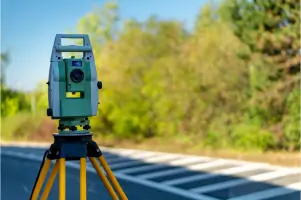
Established in 2002, Total Survey Solutions combines over 40 years of collective expertise in land and building surveying to deliver precise, high-quality services across the UK. Our team utilises cutting-edge technology, including Sokkia Total Stations and reflectorless instruments, to execute complex topographic and measured building surveys with confidence. We serve architects, developers, local authorities, and private clients, prioritising accuracy, timely delivery, and tailored solutions.Our quality assurance processes ensure rigorous checking at every stage, while our commitment to competitive pricing and client-focused service has solidified our reputation as a trusted partner. Based on the south coast but operating nationwide, we maintain full professional indemnity insurance and adhere to stringent health and safety standards, ensuring reliable, compliant service delivery.
Services
Topographic Surveys
Measured Building Surveys
Elevations
3D Scanning
Monitoring
Volume Calculations
Details
- Year established: 2002
Highlights and features
- We utilise the latest reflectorless surveying technology for unmatched accuracy.
- Our team has over 40 years of combined experience in land and building surveying.
- We offer tailored survey solutions for architects, developers, and local authorities.
- Quality assurance processes ensure error-free deliverables and timely completion.
- We operate nationwide with a focus on competitive pricing and client satisfaction.
Services
Topographic Surveys
Topographic surveys map natural and man-made features using advanced Sokkia Total Stations. Our reflectorless technology captures complex terrain with high accuracy, supporting planning, design, and development projects. Clients receive CAD-ready data tailored to their specifications.
Measured Building Surveys
Measured building surveys create detailed digital records of structures. Using reflectorless instruments, we capture hard-to-reach points to produce accurate floor plans, elevations, and sections. Data is delivered in CAD and digital formats for architectural or renovation purposes.
3D Scanning
3D scanning offers rapid, high-resolution data capture for complex structures. This technology creates immersive digital models ideal for heritage preservation, asset management, or construction verification. Clients benefit from faster turnaround times and minimally invasive surveying.
Elevations
Elevations provide detailed vertical views of buildings, tailored to client needs. Using reflectorless instruments, we produce full or outline elevations that integrate with measured surveys to form comprehensive architectural records for planning or restoration projects.
Monitoring
Monitoring services track structural movements or deformations over time. Our precise instruments detect subtle changes in buildings, bridges, or infrastructure, providing critical data for safety assessments, maintenance planning, or construction impact analysis.
People
Russell Froud
Director
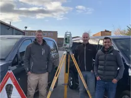
With over 20 years in surveying and civil engineering qualifications, Russell progressed from apprentice to Director at Total Survey Solutions in 2011, bringing extensive technical and project management expertise.
Curtis Dexter
Director
Curtis has over 20 years of surveying experience, advancing from apprentice to Director at Total Survey Solutions in 2011. His expertise spans project management and precision surveying for diverse construction and infrastructure projects.
Lewis Shaw
Senior Surveyor
Lewis has over a decade of surveying experience, rising from apprentice to Senior Surveyor. He specialises in measured building surveys and project management, ensuring accurate data delivery and client satisfaction.
Questions
What surveying services do you offer?
We provide topographic surveys, measured building surveys, elevations, 3D scanning, structural monitoring, and volume calculations using advanced reflectorless technology.
How experienced is your team?
Our team has over 40 years of combined experience in land and building surveying, with directors holding civil engineering qualifications and industry-recognised expertise.
Do you work outside the South of England?
While based in Dorset, we travel extensively across the UK to meet client requirements for surveying projects of all scales.
What quality assurance processes do you use?
We implement rigorous quality checks at every stage, including data verification, error detection, and archiving to ensure accurate, deliverables meeting strict deadlines.
What file formats do you provide survey data in?
We supply survey data in CAD and all major digital formats, with options for PDFs to support client-specific documentation needs.
Are you insured for professional liability?
Yes, we hold full professional indemnity insurance alongside public and employers' liability coverage for client peace of mind.