
Business Details
37 Years
experience
Precision Land Surveyors in South Manchester
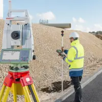
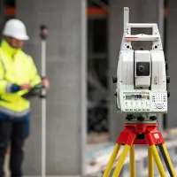
Established in 1989, we are a dedicated team of professional land surveyors headquartered in South Manchester. Our expertise spans topographical surveys, boundary delineation, measured building assessments, and underground utility detection using cutting-edge technology. With decades of collective experience, we deploy specialized survey teams equipped with Leica TS 16 instruments and dual-frequency GPR systems to deliver nationwide precision. Our methodology combines digital terrain modelling with rigorous quality assurance to meet exacting industry standards. We provide detailed 2D/3D deliverables in DWG/DXF formats while maintaining compliance with health and safety legislation.Our service portfolio extends to deformation monitoring, setting-out stakeouts, and architectural elevation documentation. Operating from our Cheshire base at 56B Carrington Lane, we serve commercial and residential clients across the UK with tailored survey solutions. Our commitment to technological advancement ensures accurate data collection for construction, development, and legal boundary resolution projects. Client satisfaction is guaranteed through transparent communication and no-obligation quotations.
Services
Topographical Surveys
Boundary Surveys
Measured Building Surveys
GPR Surveys
Digital Terrain Modelling
Elevation Drawings
Deformation Monitoring
Setting-Out Stakeouts
Details
- Year established: 1989
Highlights and features
- Established since 1989 with nationwide survey coverage
- Utilise Leica TS 16 and dual-frequency GPR technology
- Specialist teams for topographical, boundary and building surveys
- Deliver 2D/3D digital terrain models in multiple formats
- Compliant with health and safety legislation
Services
Topographical Surveys
Using Leica TS 16 instruments and dual-frequency GPR, we create detailed terrain models with sub-centimetre accuracy. Our surveys include elevation data, underground utilities mapping, and digital deliverables in DWG/DXF formats. This service supports construction planning and environmental assessments across the UK.
Measured Building Surveys
We produce precise architectural drawings using reflectorless total stations and laser scanners. Deliverables include floor plans, elevation details, and cross-section drawings tailored to client requirements. Our surveys meet planning authority specifications for residential and commercial properties nationwide.
Boundary Surveys
Our boundary resolution service combines legal deed analysis with GPS technology to define property perimeters. We provide legally compliant documentation for land disputes, development projects, and title registration across Manchester and Cheshire.
Questions
What survey technologies do you use?
We utilise Leica TS 16 total stations, dual-frequency ground-penetrating radar (GPR), and laser scanners for accurate data collection.
Do you operate outside Manchester?
Yes, we provide nationwide survey services with our Cheshire base covering the entire UK.
What file formats do you provide?
We deliver digital survey data in DWG, DXF and other common formats compatible with CAD software.
Can you handle urgent projects?
We prioritise time-sensitive work and offer expedited delivery for critical infrastructure and development projects.