Business Details
Trusted Land Surveyors in Warrington | Malcolm Hughes
Malcolm Hughes, part of the Ogilvie Group, has established itself as a leading surveying firm with over three decades of expertise in land, building, highway, and rail surveying. Our commitment to innovation, investment in cutting-edge technology, and a skilled team position us to deliver superior, precise, and timely surveying services. With nationwide coverage across the UK and Ireland, we serve diverse clients, from individual projects to large-scale national infrastructure developments.Our reputation is built on trust, transparency, and integrity, ensuring clients receive tailored solutions that meet their specific needs. As a RIBA-approved provider, we offer CPD sessions to share industry knowledge, reinforcing our dedication to advancing geospatial best practices. Direct access to senior management ensures accountability, while our heritage since 1953 through the Ogilvie Group underscores our enduring reliability and leadership in the field.

Services
Topographical Surveys
Underground Utility Mapping
Measured Building Surveys
Boundary Surveys
Highway Surveys
Railway Surveys
Hydrographic Surveys
Laser Scanning
Area Measurement
UAV Surveys
Highlights and features
- We have over 30 years of experience in geospatial surveying.
- Our team works with direct access to senior management for accountability.
- We invest in the latest technology for accurate, efficient surveys.
- Trusted by Highways Agency, Network Rail, and Environment Agency.
- Part of the Ogilvie Group with a heritage dating back to 1953.
What people say
Superior surveying service
Professional and proactive approach
High-quality outputs
Excellent communications
Cost-competitive service
Services
Underground Utility Mapping
Malcolm Hughes delivers PAS128-compliant underground utility mapping using Ground Penetrating Radar (GPR) and trial hole verification. Our surveys identify buried services to reduce excavation risks, prevent delays, and enhance site safety. Clients receive data in multiple formats, supporting infrastructure projects across the UK and Ireland.
Laser Scanning
Our laser scanning services capture detailed 3D data of buildings, infrastructure, and complex structures. Ideal for BIM projects, heritage preservation, and challenging environments, we provide point cloud data and CAD models to support accurate design and analysis.
Topographical Surveys
We conduct topographical surveys to map terrain features, contours, and existing structures. These surveys support planning applications, construction projects, and land development with precise elevation and positional data.
Measured Building Surveys
Our measured building surveys produce detailed floor plans, elevations, and sections for property management, refurbishment, or asset documentation. Using advanced tools, we ensure accuracy for commercial, residential, and historic buildings.
Area Measurement
We provide RICS and IPMS-compliant area measurements for offices, retail, and industrial spaces. Our surveys support lease agreements, valuations, and property portfolio management with consistent, auditable data.
Questions
What surveying services does Malcolm Hughes offer?
We provide topographical surveys, underground utility mapping, measured building surveys, laser scanning, area measurement, and UAV surveys, among others.
Are your surveys compliant with industry standards?
Yes, our utility mapping follows PAS128 standards, and we adhere to RICS and IPMS guidelines for area measurements.
Which sectors do you work with?
We support infrastructure, construction, property, transport, and heritage sectors across the UK and Ireland.
Can you provide surveys for BIM projects?
Yes, our laser scanning and 3D modelling services are integral to BIM workflows for accurate design and construction data.
How do you ensure data accuracy?
We use advanced technologies like GPR, laser scanning, and UAVs, combined with experienced surveyors and rigorous quality checks.
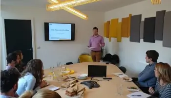
Do you offer CPD sessions?
Yes, we provide RIBA-approved CPD presentations on geospatial surveying methods and technologies for industry professionals.
Videos