
Business Details
40 Years
experience
Emergency
services
Expert Surveying Services in Skelmersdale
Established in 1986, Survey Operations has evolved into one of the UK's foremost surveying companies. Our expertise spans land, building, utility, UAV, mobile mapping, and hydrographic surveying, supported by a dedicated team of over 80 professionals. We combine cutting-edge technology with rigorous quality standards, including ISO 9001 and ISO 14001 certifications, to deliver precise, reliable solutions for construction, infrastructure, and environmental projects. Our commitment to innovation is demonstrated through advanced tools like 3D laser scanning, BIM integration, and UAV photogrammetry.With nationwide coverage and a fleet of 30+ vehicles, we serve design consultants, government agencies, and private clients across diverse sectors. Our membership in The Survey Association and Royal Institute of Chartered Surveyors underscores our adherence to industry excellence. From historic preservation to coastal monitoring, we tackle complex challenges with technical precision and client-focused service.
Services
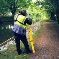
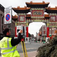
Land Surveys
Building Surveys
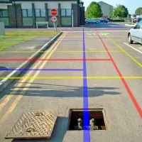
Utility Surveys
UAV Surveys
Mobile Mapping
Hydrographic Surveys
Laser Scanning
Engineering Surveys
Details
- Year established: 1986
Highlights and features
- Established in 1986 with 35+ years of surveying expertise
- ISO 9001 certified quality management systems
- Nationwide coverage with 30+ survey vehicles
- Advanced technology including UAV and 3D laser scanning
- Accredited by The Survey Association and RICS
Associations and certifications
- ISO 14001
- ISO 9001
- ISO 45001
- Constructionline Gold
- CHAS Advanced
- UVDB
- The Survey Association
- RISQS
- Alcumus SafeContractor
- European GPR Association
What people say
Precise measurements
Advanced technology
Reliable data
Expert team
Timely delivery
Services
Land Surveys
Our land surveys provide detailed terrain mapping for development projects. Using GNSS and total stations, we deliver accurate elevation data and boundary definitions. Clients benefit from precise measurements for planning applications, construction layouts, and environmental assessments across sites ranging from small plots to large infrastructure projects.
3D Laser Scanning
High-accuracy 3D laser scanning captures detailed structural and environmental data. This non-contact method produces millions of measurement points for BIM integration, heritage preservation, and engineering analysis. Clients receive comprehensive digital twins for design validation, asset management, and forensic investigations with millimetre-level precision.
Hydrographic Surveys
Specialised waterbody mapping using multi-beam sonar and echo sounders. We assess reservoir capacities, river morphology, and coastal changes. Clients gain critical data for flood risk management, infrastructure planning, and environmental monitoring through detailed bathymetric charts and volumetric calculations for inland waterways and coastal zones.
UAV Surveys
Aerial surveys using fixed-wing and rotary drones capture high-resolution imagery and LiDAR data. This technology enables rapid site mapping, progress monitoring, and volumetric calculations. Clients benefit from cost-effective, safe data collection for large areas, construction sites, and difficult-to-access structures with centimetre-level accuracy.
Utility Surveys
PAS128-compliant utility detection locates buried services using GPR and electromagnetic detection. We identify water, gas, electricity, and telecom infrastructure to prevent damage during construction. Clients receive detailed subsurface maps for safe excavation planning, compliance with safety regulations, and asset management across urban and rural environments.
People
Ian Smith
Commercial Manager
With over 20 years in surveying, Ian specialises in client relations and project specifications. He ensures client requirements align with technical capabilities, maintaining Survey Operations' reputation for tailored solutions.
Dave Birchall
Operations Manager
Managing survey resources and project control, Dave brings 15+ years of operational expertise. He coordinates field teams to meet deadlines while maintaining quality standards across diverse surveying disciplines.
Simon Beaumont
Engineering & SHEQ Manager
Simon oversees quality procedures and safety compliance. With engineering surveying expertise, he ensures adherence to ISO standards and industry best practices across all surveying operations.
Matt Holder
CAD Verification Manager
Responsible for CAD deliverables, Matt ensures technical accuracy in survey outputs. He manages digital data conversion and verification processes, maintaining precision in BIM and Revit model production.
Aaron Jenkins
Office Support
Handling day-to-day office operations, Aaron coordinates supplier relationships and administrative functions. His organisational skills ensure smooth internal processes supporting field surveying activities.
Questions
What surveying services does Survey Operations offer?
We provide land, building, utility, UAV, hydrographic, and engineering surveys using advanced technologies like 3D laser scanning and BIM integration.
Are your surveyors certified professionals?
Yes, our team holds ISO 9001 certification and industry accreditations, with 80+ experienced surveyors and engineers across the UK.
Can you handle emergency surveying requirements?
Yes, we offer emergency flood data recording and urgent surveying services with rapid mobilisation capabilities.
What technology do you use for surveys?
We utilise GNSS, 3D laser scanning, UAV photogrammetry, multi-beam sonar, and GPR for accurate data collection across all survey types.
Do you work nationwide?
Yes, we operate throughout the UK with a fleet of 30+ vehicles and equipment for remote site access including drones and boats.
How do you ensure survey accuracy?
Through ISO-certified quality systems, regular equipment calibration, and rigorous data validation processes meeting PAS128 and industry standards.
Videos